↓
 
Ashland Hiking Group 
 
  • About Us
  • Posted Hikes
    • Recent
    • Monday
    • Wednesday
    • Friday
    • Friday Flower
  • Hike Schedules
    • Monday
      • Current
      • Previous
    • Wednesday
      • Current
      • Previous
    • Friday
      • Current
      • Previous
    • Friday Flower
      • Current
      • Previous
  • Locations
    • Lakes
      • Applegate Lake
      • Azalea Lake
      • Castle Lake
      • Crater Lake
      • Duck Lakes
      • East Boulder Lake
      • Emigrant Lake
      • Fish Lake
      • Kangaroo Lake
      • Lost Creek Lake
      • Mountain Lakes
      • Puck Lakes
      • Seven Lakes
      • Sky Lakes
      • Smith Lake
      • Squaw Lakes
      • Taylor Lake
    • PCT
      • Brown Mountain
      • Castle Crags
      • Cement Bluff
      • Etna Summit
      • Greensprings Area
      • Gumboot Boulder
      • Hyatt/Greensprings Summit
      • Hyatt Reservoir
      • Mt Ashland Area
      • Pilot Rock Area
      • Porcupine Lake
      • Red Buttes
    • Rivers & Streams
      • Elk Creek
      • Frog Pond
      • Kelsey Creek
      • Lower Rogue
      • Mill Creek Falls
      • Sacramento River
      • Squaw Valley Creek
      • Upper Rogue
      • Taylor Creek
    • Snow Shoes
      • Buck Prairie
      • Crater Lake
      • Deadwood
      • Great Meadow
      • Grouse Gap
      • Hyatt Lake
      • Moon Prairie
      • Mt Ashland
      • Mt Shasta
      • Pederson
      • Pilot Rock
      • Summit Sno-Park
    • Mountains & Summits
      • A>L
        • Abbot Butte
        • Anderson Butte
        • Arch Rock
        • Baldy Peak
        • Big Red Mountain
        • Bolt Mountain
        • Castle Crags
        • Collings Mountain
        • Frank Hill Road
        • Grayback Mountain
        • Grizzly Peak
        • Kerby Peak
      • M>Z
        • Mount Ashland
        • Mount Bailey
        • Mount Eddy
        • Mount Elijah
        • Mount Shasta
        • Pompadour Bluff
        • Roxy Ann
        • Squaw Peak
        • Stein Butte
        • Stukel Mountain
        • Table Rocks
        • Union Peak
        • Wagner Butte
    • Woods
      • Ashland City
      • Ashland Watershed
      • Bear Creek Greenway
      • Cathedral Hills
      • Denman Wildlife Refuge
      • East Applegate Ridge
      • Enchanted Forest
      • Greenhorn Park
      • Greensprings Area
      • High Lakes Trail
      • Horseshoe Ranch
      • Jack Ash
      • Jacksonville
      • Layton Mine Ditch
      • Pacifica
      • Sterling Mine Ditch
      • Steves 40 Acres
    • Miscellaneous
  • Images
    • Resize @ 1000H ,1000V & med before uploading
  • Log In

Post navigation

← Older posts
Newer posts →

Upper Table Rock

Ashland Hiking Group Posted on December 6, 2023 by Randy BryanApril 23, 2024

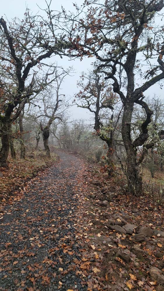
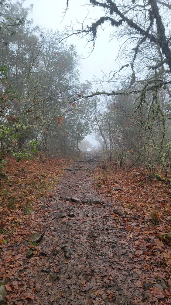
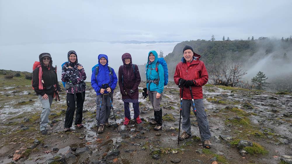
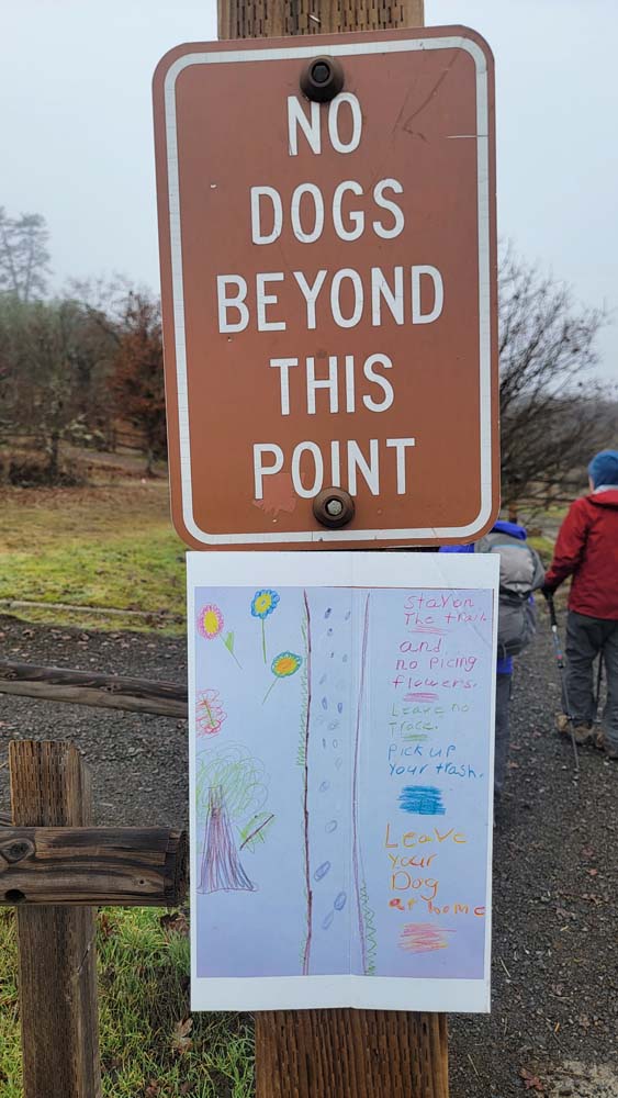
On December 6, 2023 six of us braved the report of 100% chance of rain. We had low fog and mostly just the moisture from that. When we got to the trailhead, we could see a pile of gravel that was left over from covering the new trail route. There are added signs about why the trail is not for dogs.

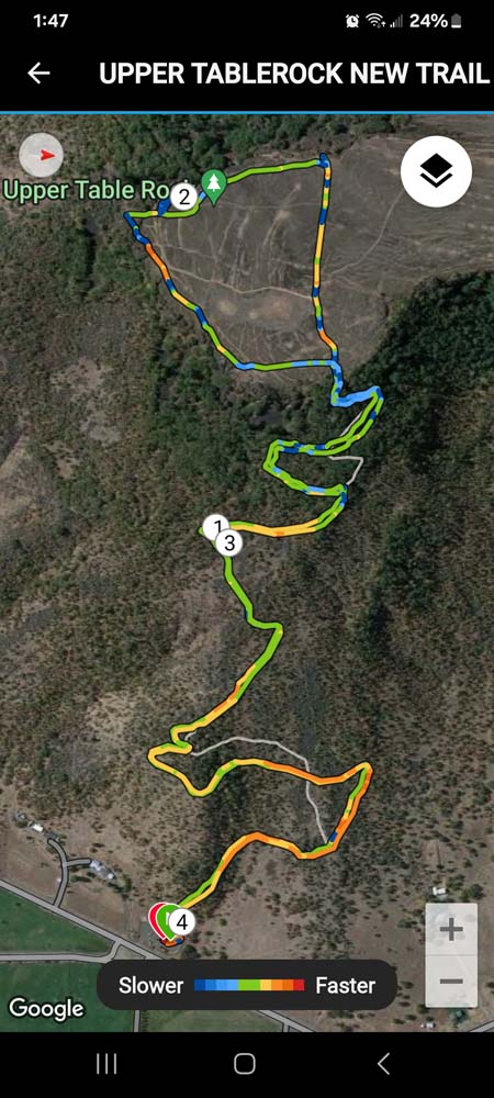
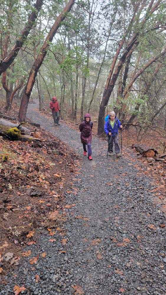
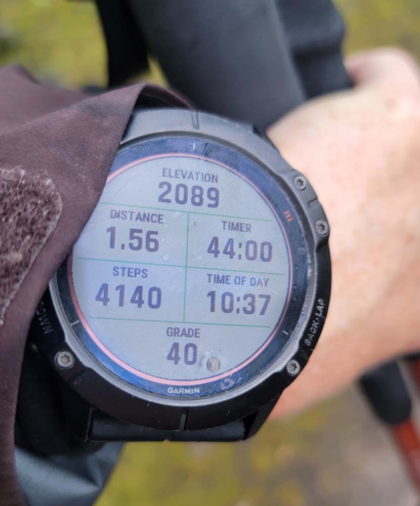
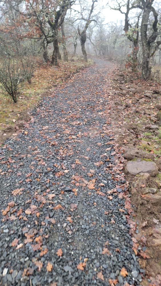
As we headed up, we could see where the trail looks like it has been widened and rocks dispersed along the side. There was also some hay covering the exposed mud. The trail is about 3/10 of a mile longer each way, but it isn’t quite as steep. The sign at the trailhead says it should be 2.5 miles round trip (this is the old mileage) making one way 1.25 miles. When we reached the top, I took a photo of my watch and it said we had gone 1.56 miles. I started my track at my car and it is included in the photos. You can see the old trail in grey. The colored lines are the route we took. They have blocked off the old trail with a downed tree.

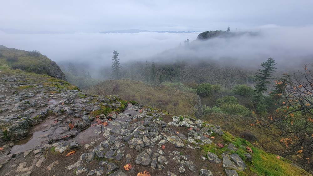
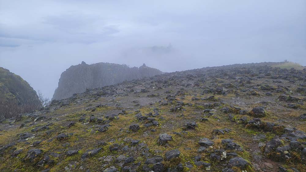
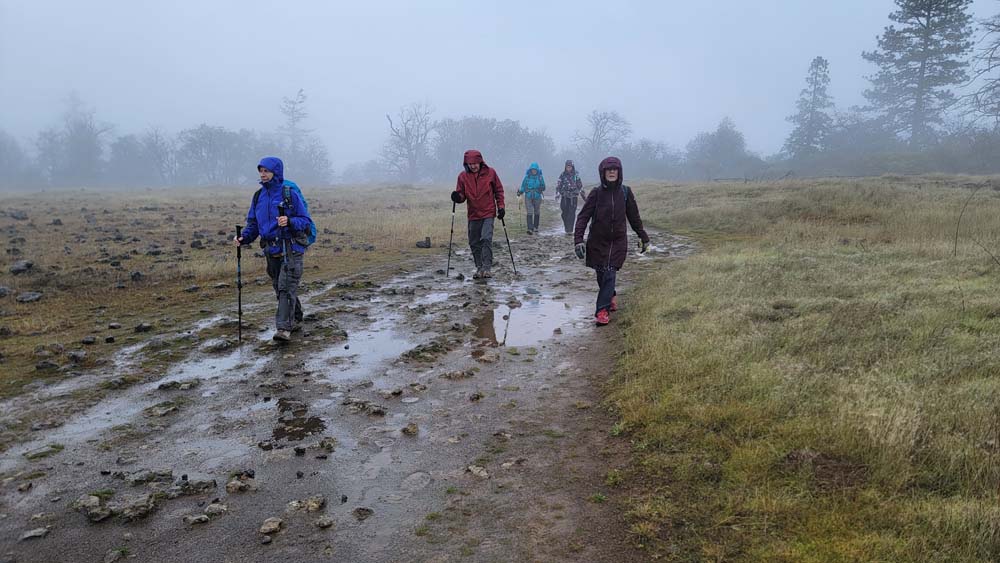
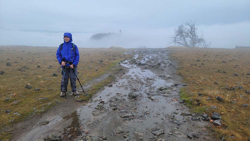
When we reached the top, it was very foggy and we could only see a little ways in front of us. We headed across following one of the trails. As we reached the other side, some of the fog lifted. We could hear airplanes, then see them emerge out of the clouds. We continued around the edge and the sun almost emerged.

We headed back down to our cars and just got some misty drizzle rain. We were finished by noon and were happy to be able to run errands in town if needed. I myself stopped at the Franz Bread outlet and I believe Steve and Maria were able to make a Costco stop.

Hike Leader: Francie

Photos By: Francie

Posted in Mountains & Summits, Table Rocks, Wednesday

Post navigation

← Older posts
Newer posts →
↑