↓
 
Ashland Hiking Group 
 
  • About Us
  • Posted Hikes
    • Recent
    • Monday
    • Wednesday
    • Friday
    • Friday Flower
  • Hike Schedules
    • Monday
      • Current
      • Previous
    • Wednesday
      • Current
      • Previous
    • Friday
      • Current
      • Previous
    • Friday Flower
      • Current
      • Previous
  • Locations
    • Lakes
      • Applegate Lake
      • Azalea Lake
      • Castle Lake
      • Crater Lake
      • Duck Lakes
      • East Boulder Lake
      • Emigrant Lake
      • Fish Lake
      • Kangaroo Lake
      • Lost Creek Lake
      • Mountain Lakes
      • Puck Lakes
      • Seven Lakes
      • Sky Lakes
      • Smith Lake
      • Squaw Lakes
      • Taylor Lake
    • PCT
      • Brown Mountain
      • Castle Crags
      • Cement Bluff
      • Etna Summit
      • Greensprings Area
      • Gumboot Boulder
      • Hyatt/Greensprings Summit
      • Hyatt Reservoir
      • Mt Ashland Area
      • Pilot Rock Area
      • Porcupine Lake
      • Red Buttes
    • Rivers & Streams
      • Elk Creek
      • Frog Pond
      • Kelsey Creek
      • Lower Rogue
      • Mill Creek Falls
      • Sacramento River
      • Squaw Valley Creek
      • Upper Rogue
      • Taylor Creek
    • Snow Shoes
      • Buck Prairie
      • Crater Lake
      • Deadwood
      • Great Meadow
      • Grouse Gap
      • Hyatt Lake
      • Moon Prairie
      • Mt Ashland
      • Mt Shasta
      • Pederson
      • Pilot Rock
      • Summit Sno-Park
    • Mountains & Summits
      • A>L
        • Abbot Butte
        • Anderson Butte
        • Arch Rock
        • Baldy Peak
        • Big Red Mountain
        • Bolt Mountain
        • Castle Crags
        • Collings Mountain
        • Frank Hill Road
        • Grayback Mountain
        • Grizzly Peak
        • Kerby Peak
      • M>Z
        • Mount Ashland
        • Mount Bailey
        • Mount Eddy
        • Mount Elijah
        • Mount Shasta
        • Pompadour Bluff
        • Roxy Ann
        • Squaw Peak
        • Stein Butte
        • Stukel Mountain
        • Table Rocks
        • Union Peak
        • Wagner Butte
    • Woods
      • Ashland City
      • Ashland Watershed
      • Bear Creek Greenway
      • Cathedral Hills
      • Denman Wildlife Refuge
      • East Applegate Ridge
      • Enchanted Forest
      • Greenhorn Park
      • Greensprings Area
      • High Lakes Trail
      • Horseshoe Ranch
      • Jack Ash
      • Jacksonville
      • Layton Mine Ditch
      • Pacifica
      • Sterling Mine Ditch
      • Steves 40 Acres
    • Miscellaneous
  • Images
    • Resize @ 1000H ,1000V & med before uploading
  • Log In

Post navigation

← Older posts
Newer posts →

LOWER ROGUE GRAVES CREEK TO ALDER CREEK

Ashland Hiking Group Posted on March 20, 2024 by Francie SkinnerApril 23, 2024

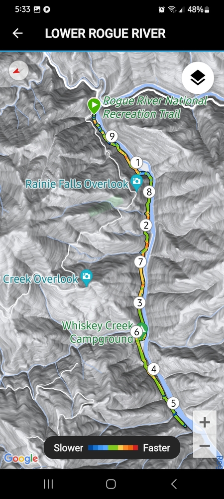
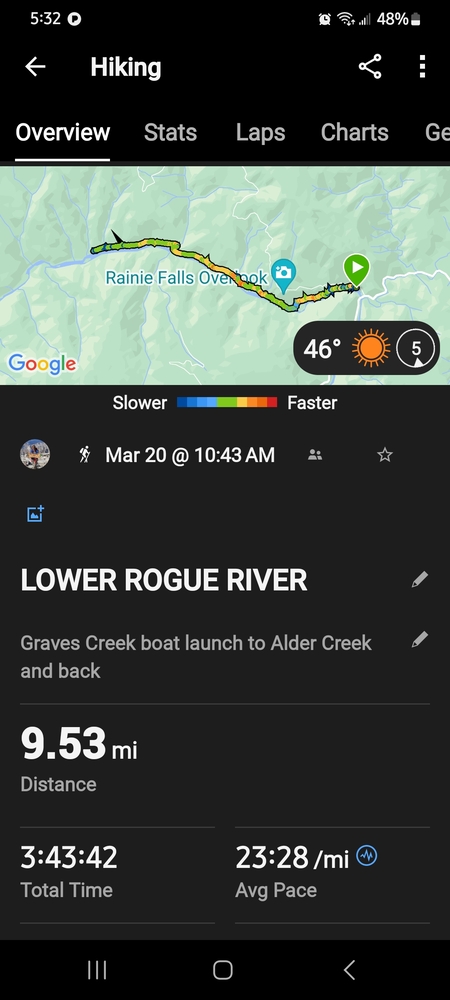
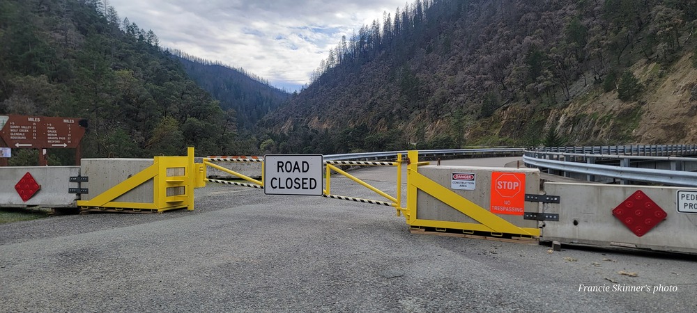
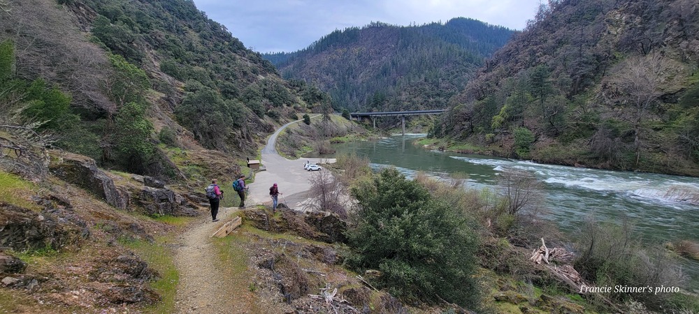
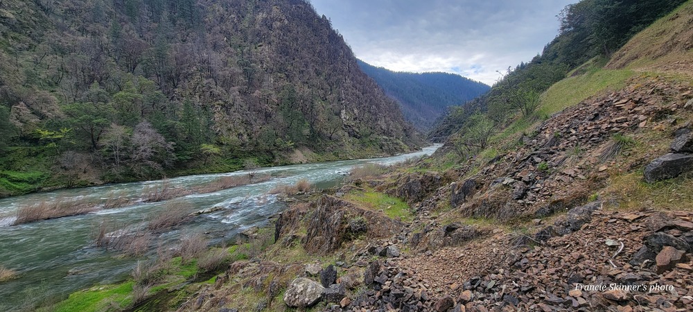
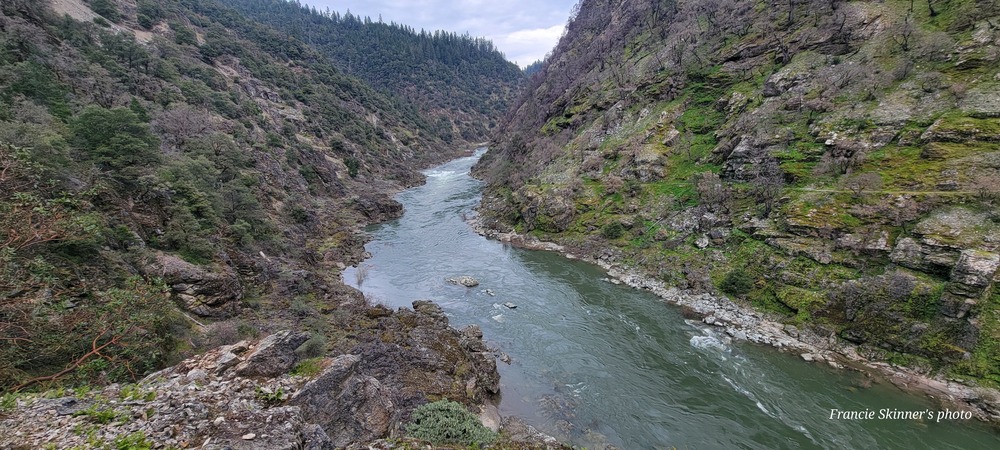
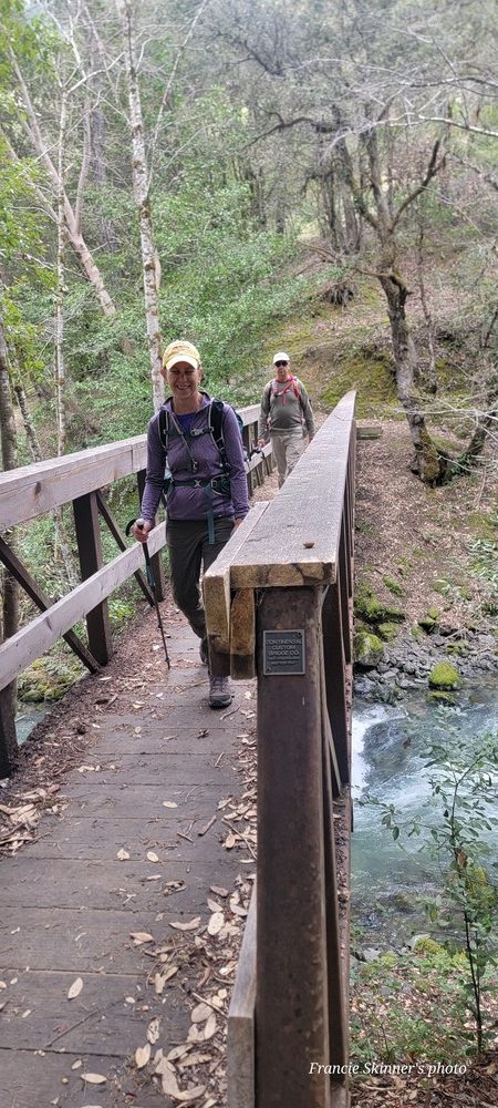
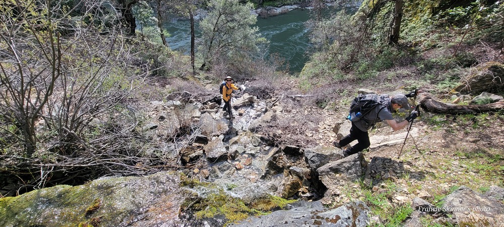
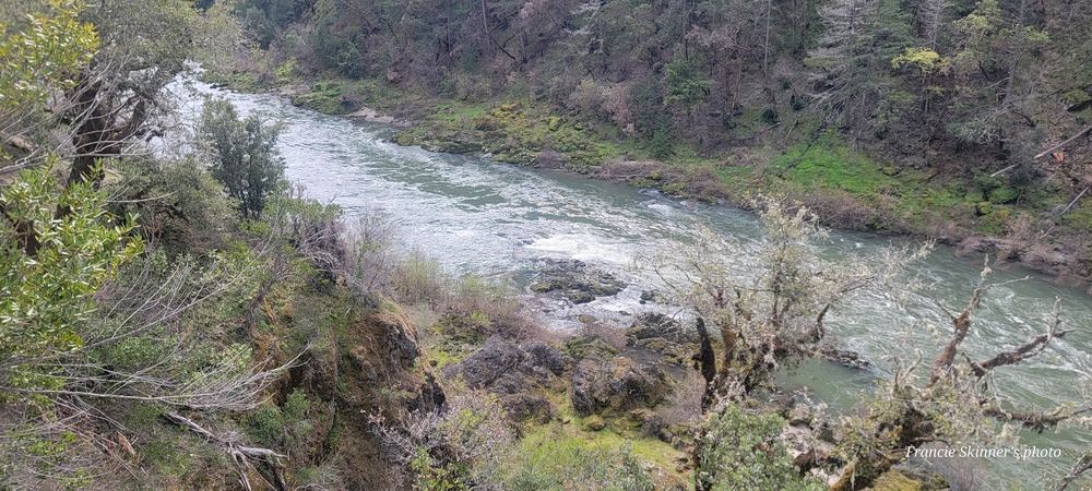
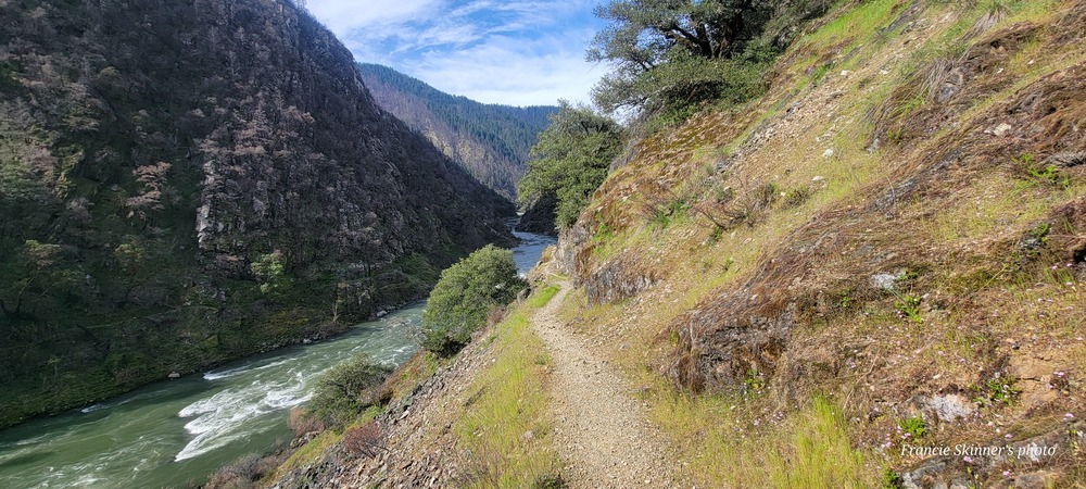
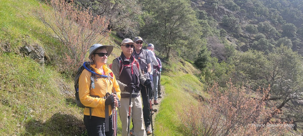
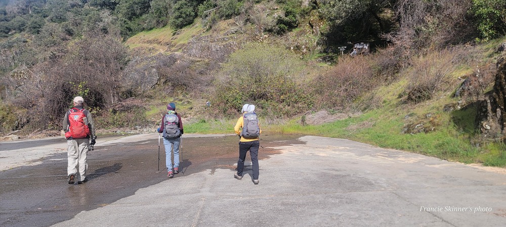
On Wednesday March 20th we had 7 hikers come out to hike the Lower Rogue River from the Graves Creek boat launch to Alder Creek and back. The road through Galice is still closed due to rock slides from last year, so we drove up to exit 71 near Sunny Valley to get to the trailhead. Both of the bathrooms were locked and they have removed the porta potty which surprised all of us. We got a late start and didn’t begin hiking until 10:43am.
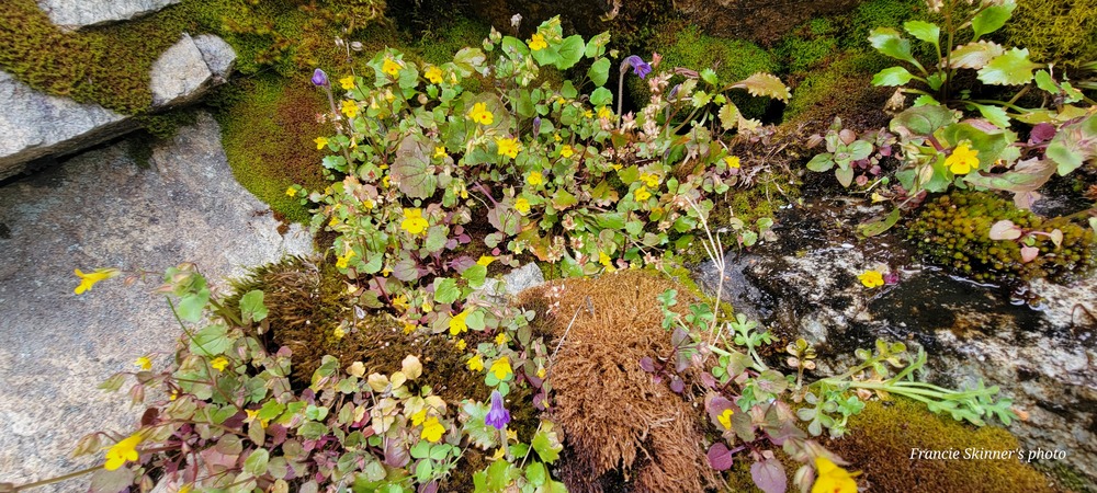
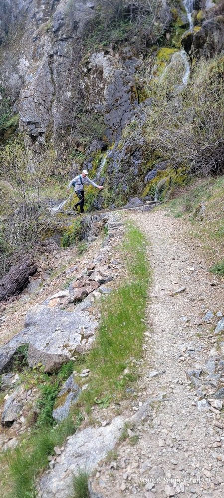
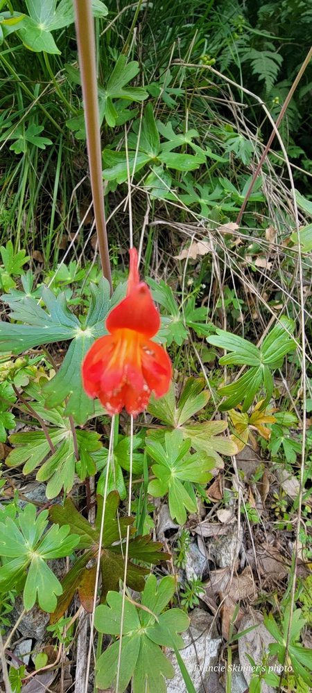
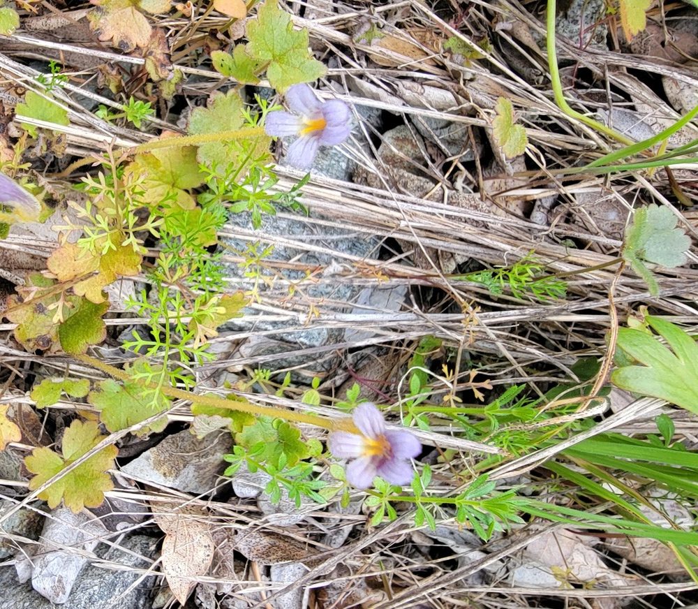
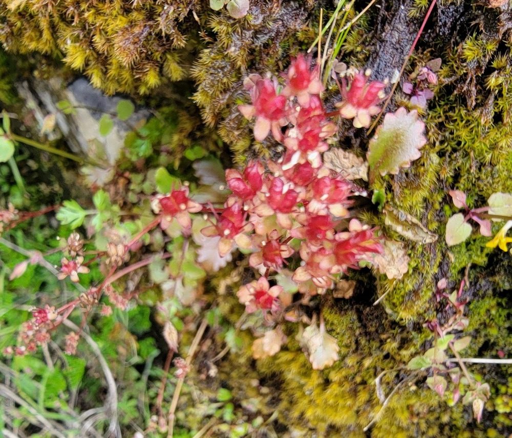
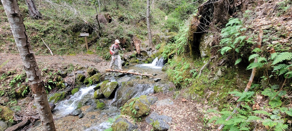
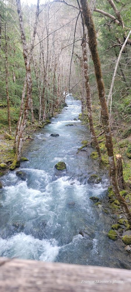
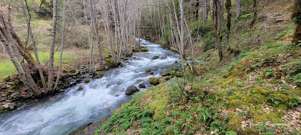
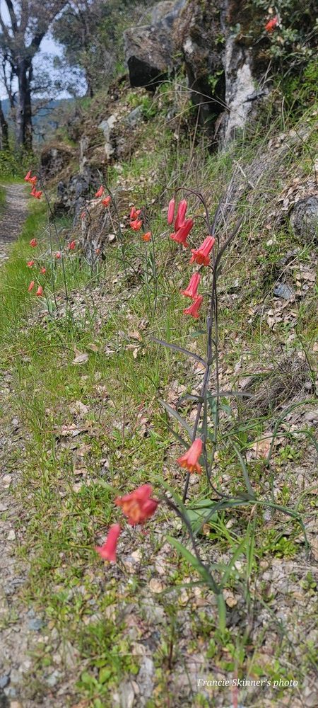
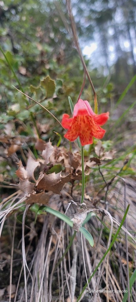
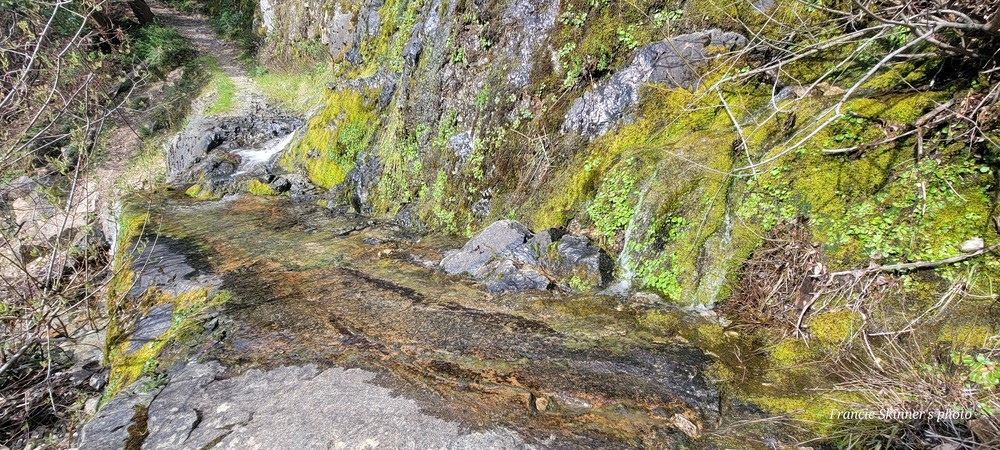
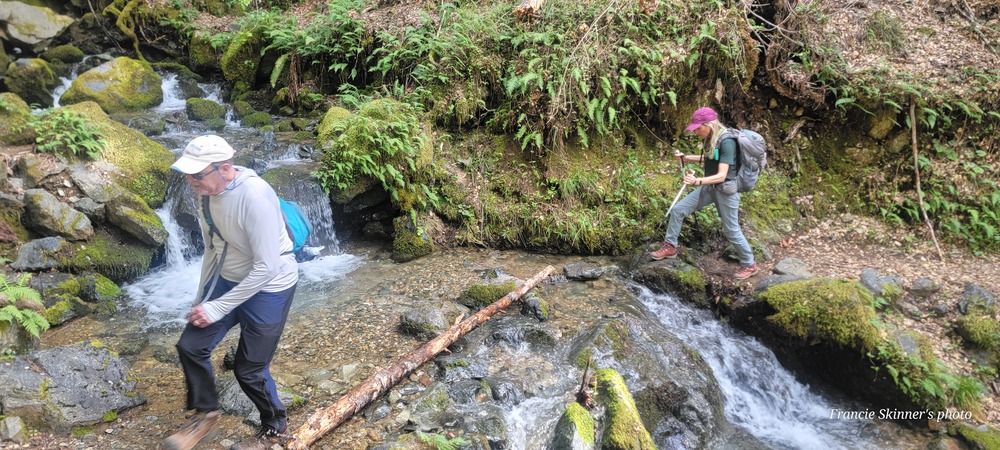
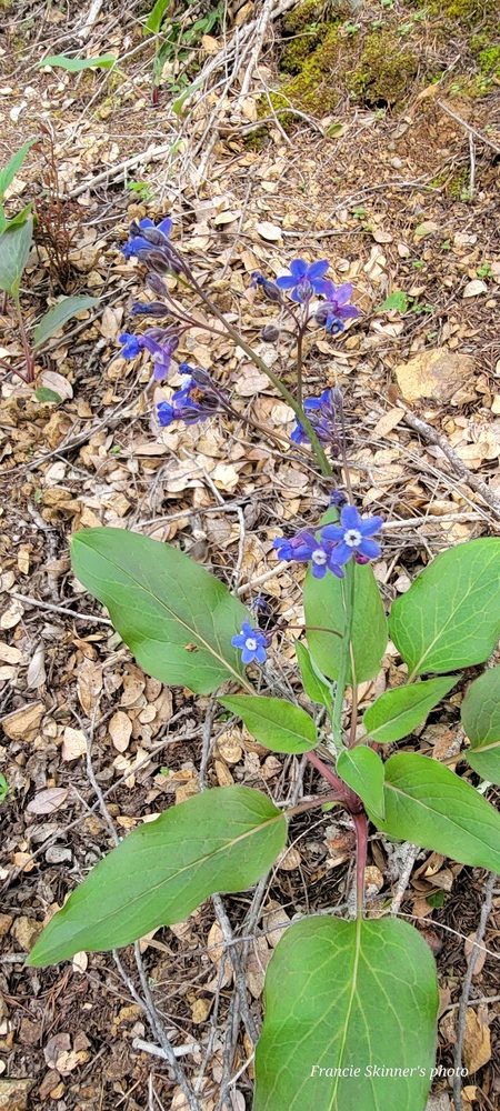
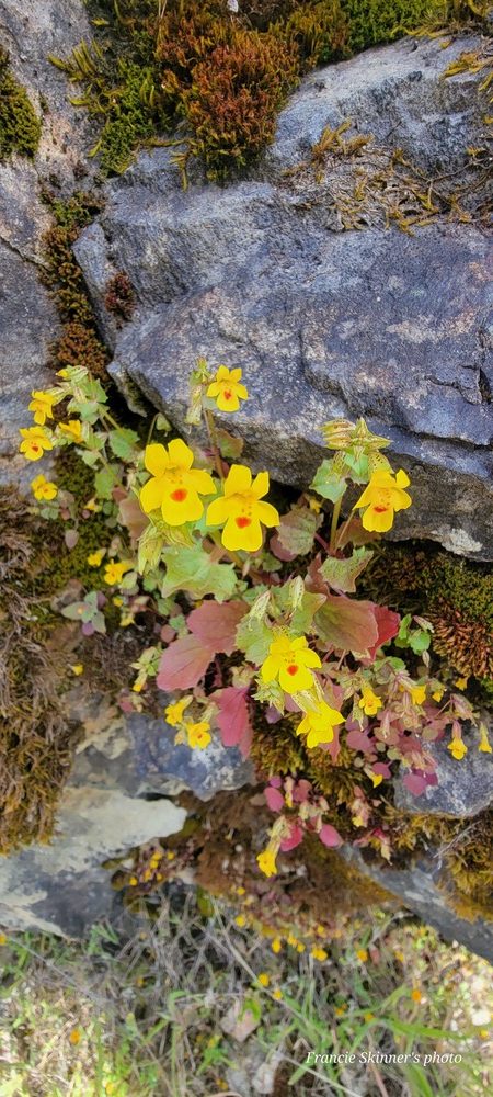
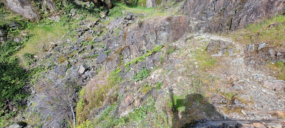
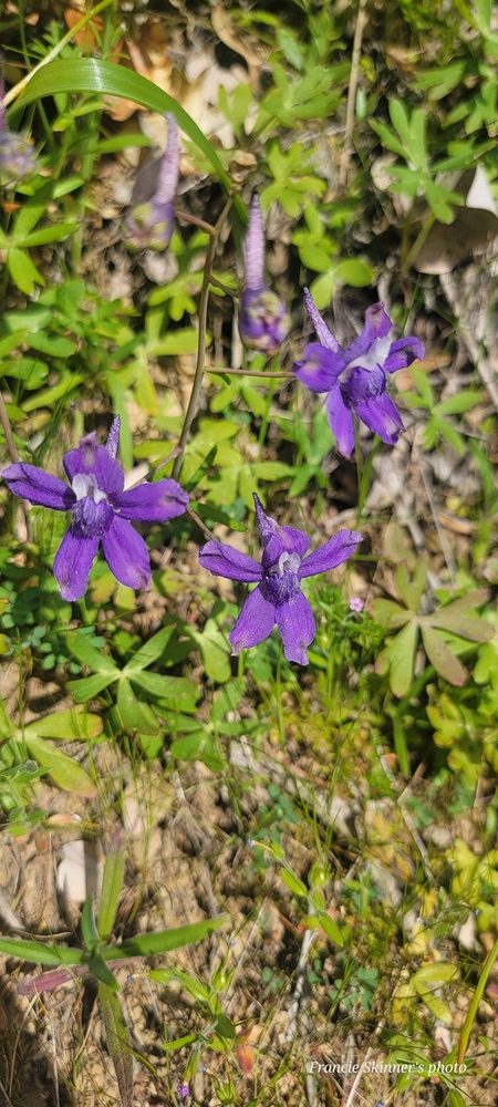
We saw many flowers blooming along the way. This is the only place that I can recall seeing the Delphinium Nudicaule also known as Red Larkspur. There were also Monkey Head, Shooting Stars and various others. There were also many places that we needed to do a water crossing. The 1st one usually has a lot of moss and can be very slippery. We could see where there was a trail down below so we all chose to take that. On the way back, we made the same decision with the exception of Bob. He successfully crossed without slipping.
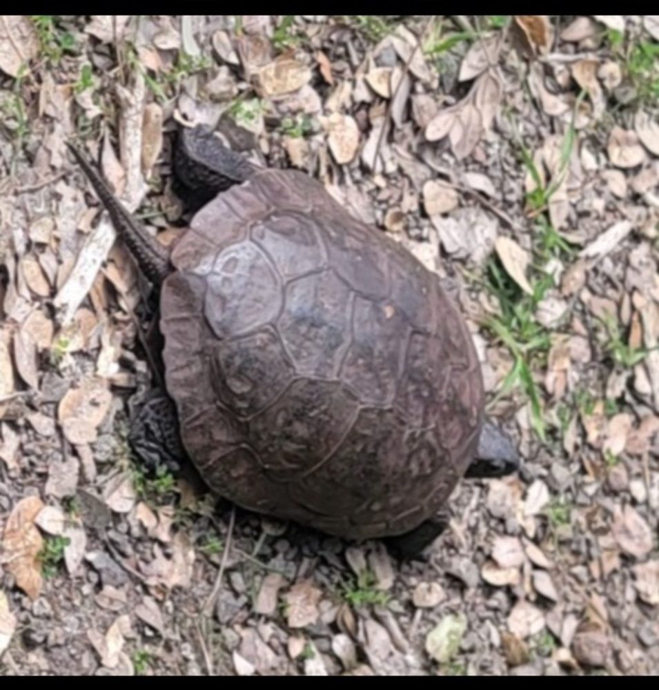
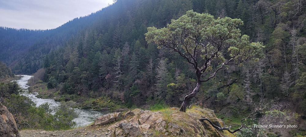
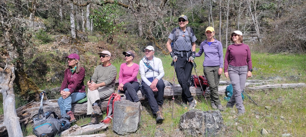
We stopped for a snack just beyond the bridge across Whiskey Creek. From there, we continued on to Alder Creek. At one point, we came across a turtle sitting in the middle of the trail. We had a nice lunch and enjoyed the sound of the river. We hiked back to our cars having hiked 9.5 miles with around 1600 feet of cumulative elevation gain and and finished around 3:45pm

Hike Leader: Francie

Photos By: Francie & Nanci

Posted in Lower Rogue, Rivers & Streams, Wednesday

Post navigation

← Older posts
Newer posts →
↑