↓
 
Ashland Hiking Group 
 
  • About Us
  • Posted Hikes
    • Recent
    • Monday
    • Wednesday
    • Friday
    • Friday Flower
  • Hike Schedules
    • Monday
      • Current
      • Previous
    • Wednesday
      • Current
      • Previous
    • Friday
      • Current
      • Previous
    • Friday Flower
      • Current
      • Previous
  • Locations
    • Lakes
      • Applegate Lake
      • Azalea Lake
      • Castle Lake
      • Crater Lake
      • Duck Lakes
      • East Boulder Lake
      • Emigrant Lake
      • Fish Lake
      • Kangaroo Lake
      • Lost Creek Lake
      • Mountain Lakes
      • Puck Lakes
      • Seven Lakes
      • Sky Lakes
      • Smith Lake
      • Squaw Lakes
      • Taylor Lake
    • PCT
      • Brown Mountain
      • Castle Crags
      • Cement Bluff
      • Etna Summit
      • Greensprings Area
      • Gumboot Boulder
      • Hyatt/Greensprings Summit
      • Hyatt Reservoir
      • Mt Ashland Area
      • Pilot Rock Area
      • Porcupine Lake
      • Red Buttes
    • Rivers & Streams
      • Elk Creek
      • Frog Pond
      • Kelsey Creek
      • Lower Rogue
      • Mill Creek Falls
      • Sacramento River
      • Squaw Valley Creek
      • Upper Rogue
      • Taylor Creek
    • Snow Shoes
      • Buck Prairie
      • Crater Lake
      • Deadwood
      • Great Meadow
      • Grouse Gap
      • Hyatt Lake
      • Moon Prairie
      • Mt Ashland
      • Mt Shasta
      • Pederson
      • Pilot Rock
      • Summit Sno-Park
    • Mountains & Summits
      • A>L
        • Abbot Butte
        • Anderson Butte
        • Arch Rock
        • Baldy Peak
        • Big Red Mountain
        • Bolt Mountain
        • Castle Crags
        • Collings Mountain
        • Frank Hill Road
        • Grayback Mountain
        • Grizzly Peak
        • Kerby Peak
      • M>Z
        • Mount Ashland
        • Mount Bailey
        • Mount Eddy
        • Mount Elijah
        • Mount Shasta
        • Pompadour Bluff
        • Roxy Ann
        • Squaw Peak
        • Stein Butte
        • Stukel Mountain
        • Table Rocks
        • Union Peak
        • Wagner Butte
    • Woods
      • Ashland City
      • Ashland Watershed
      • Bear Creek Greenway
      • Cathedral Hills
      • Denman Wildlife Refuge
      • East Applegate Ridge
      • Enchanted Forest
      • Greenhorn Park
      • Greensprings Area
      • High Lakes Trail
      • Horseshoe Ranch
      • Jack Ash
      • Jacksonville
      • Layton Mine Ditch
      • Pacifica
      • Sterling Mine Ditch
      • Steves 40 Acres
    • Miscellaneous
  • Images
    • Resize @ 1000H ,1000V & med before uploading
  • Log In

Post navigation

← Older posts
Newer posts →

Lower Rogue to Whiskey Creek

Ashland Hiking Group Posted on March 18, 2024 by Randy BryanApril 23, 2024

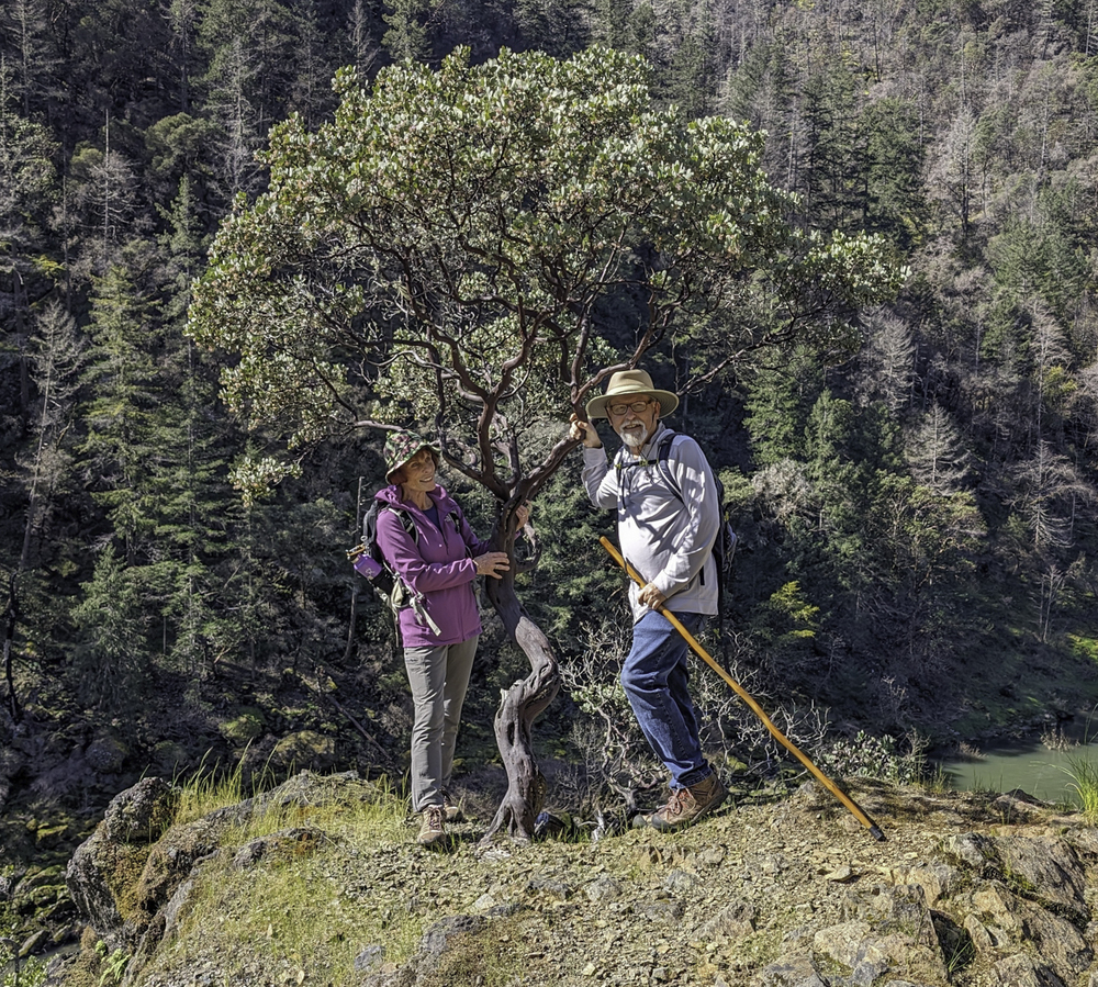
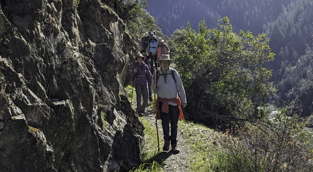
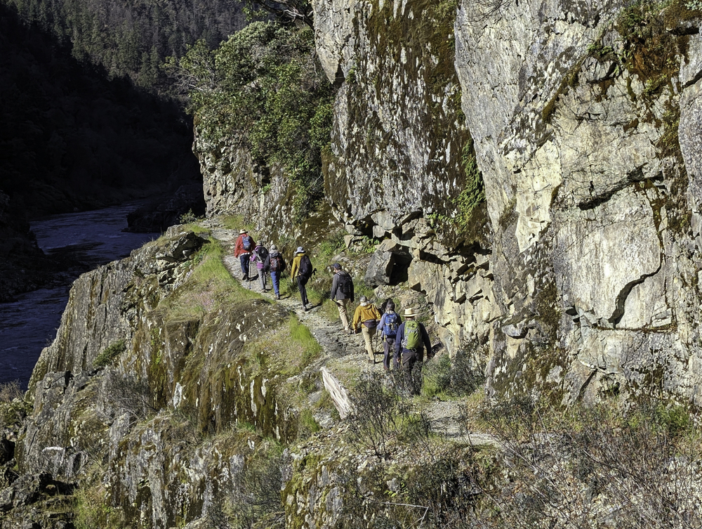
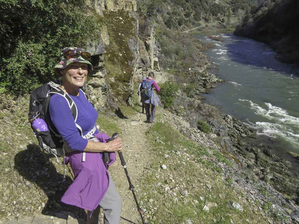
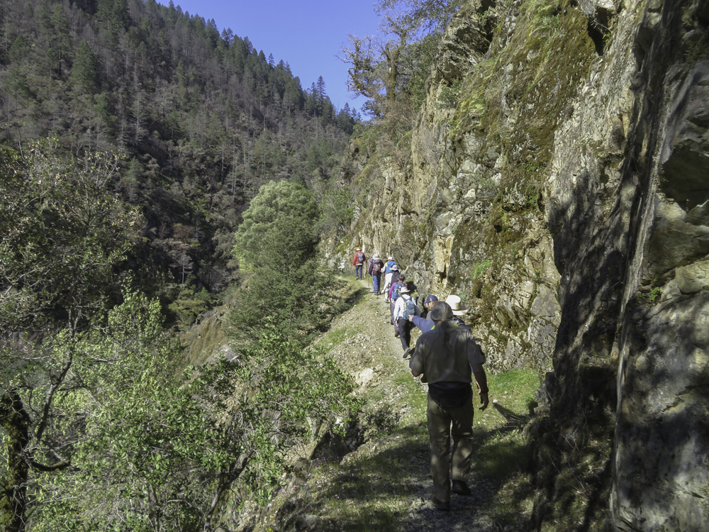
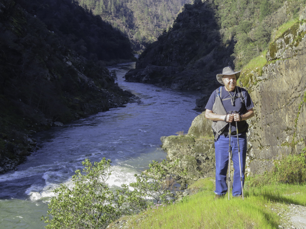
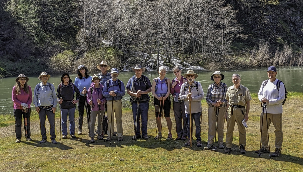
The weather man forecasted a perfect spring day so we headed up to the Lower Rogue River for one of our favorite hikes. Ten from Ashland met four more at the trailhead.

With the bridge still closed as a result from the 2022 Rum Creek fire, we took Exit 71(Sunny Valley) off I-5 and wound our way 10 miles along Grave Creek to the north side of the Rogue.

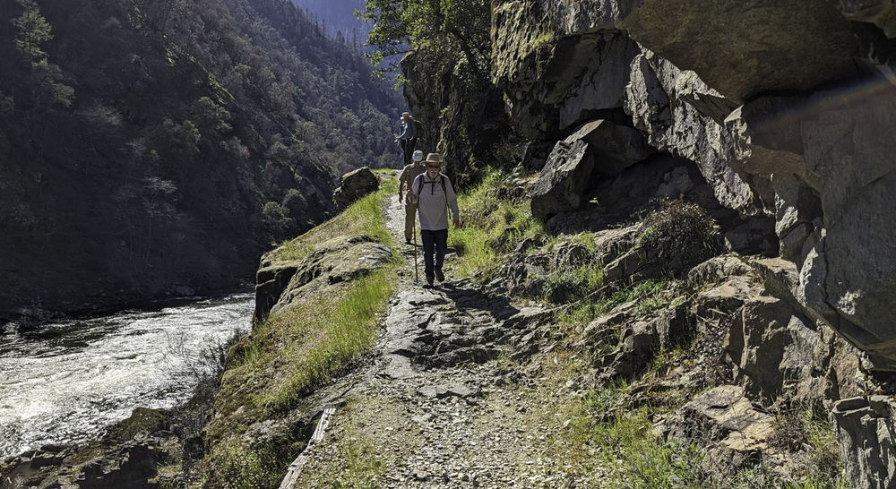
At parking, some were wondering if they had brought enough clothes as a cool morning breeze blew through. But once up on the trail the breeze stopped and we could feel the welcomed sun. So it was a very lucky day to be out hiking the Lower Rogue and not a day for layers but for sunscreen and sun hats.

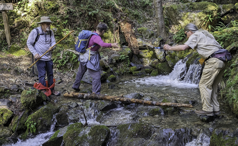
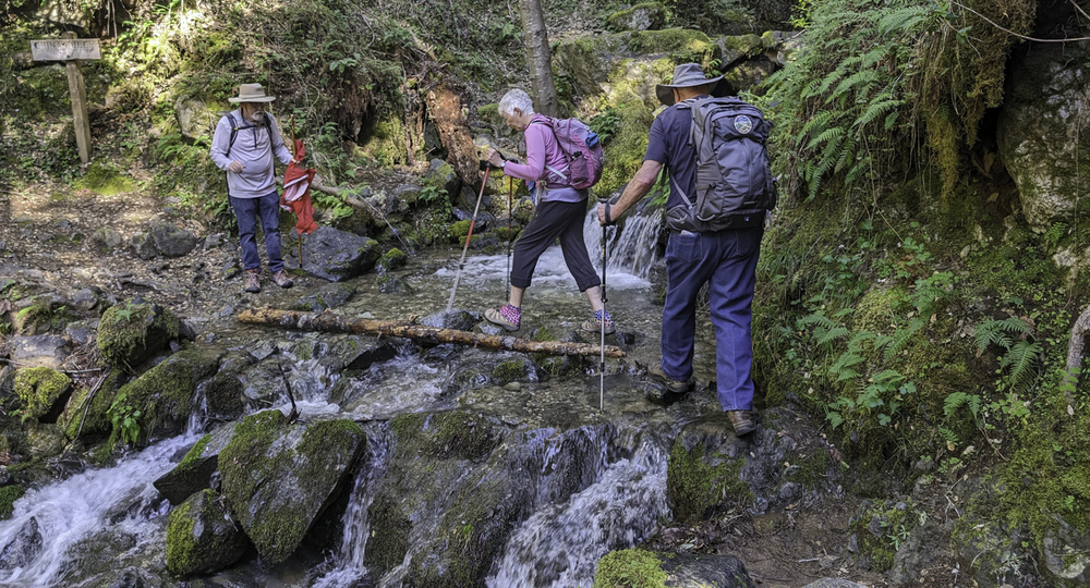
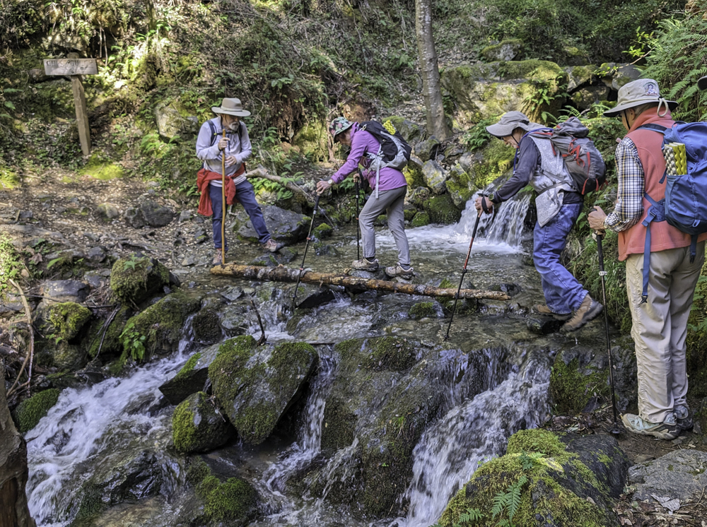
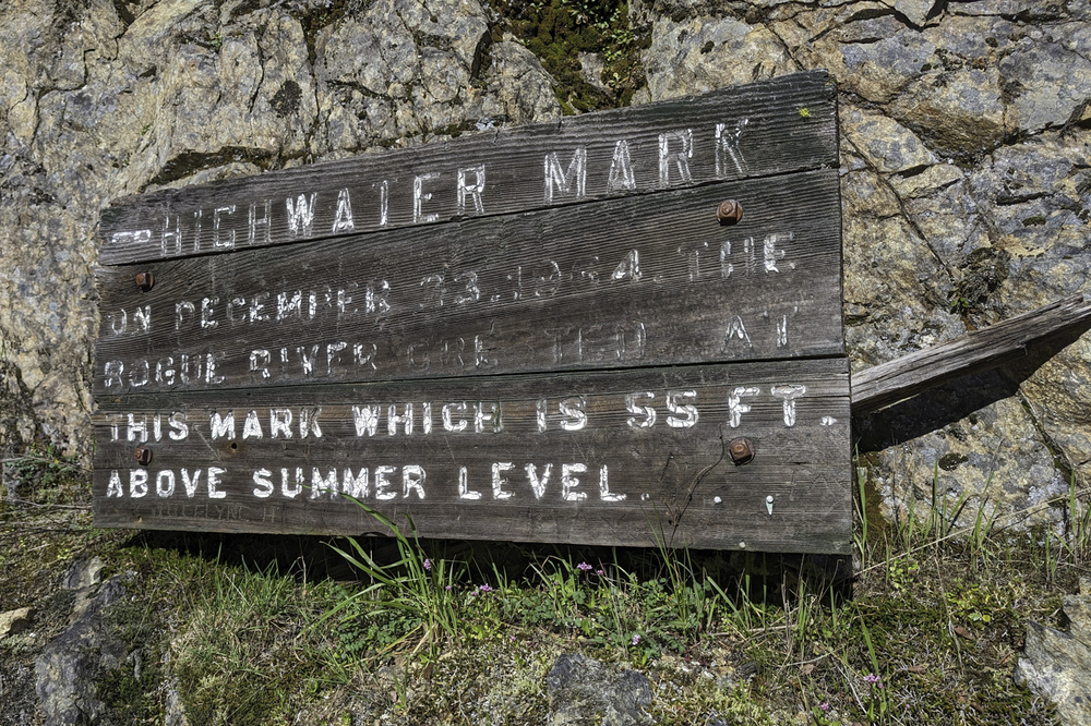
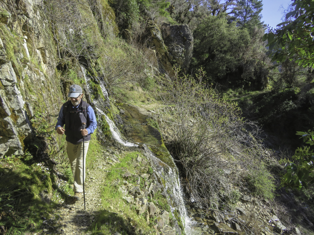
At this time of the year, one can expect spring runoff from snow melt at the seven seasonal water crossings on the trail. The first was easily apparent as water was flowing into the parking lot.

High praise to all of our hikers who made it across all of the crossings on various stones without any falls or damage!

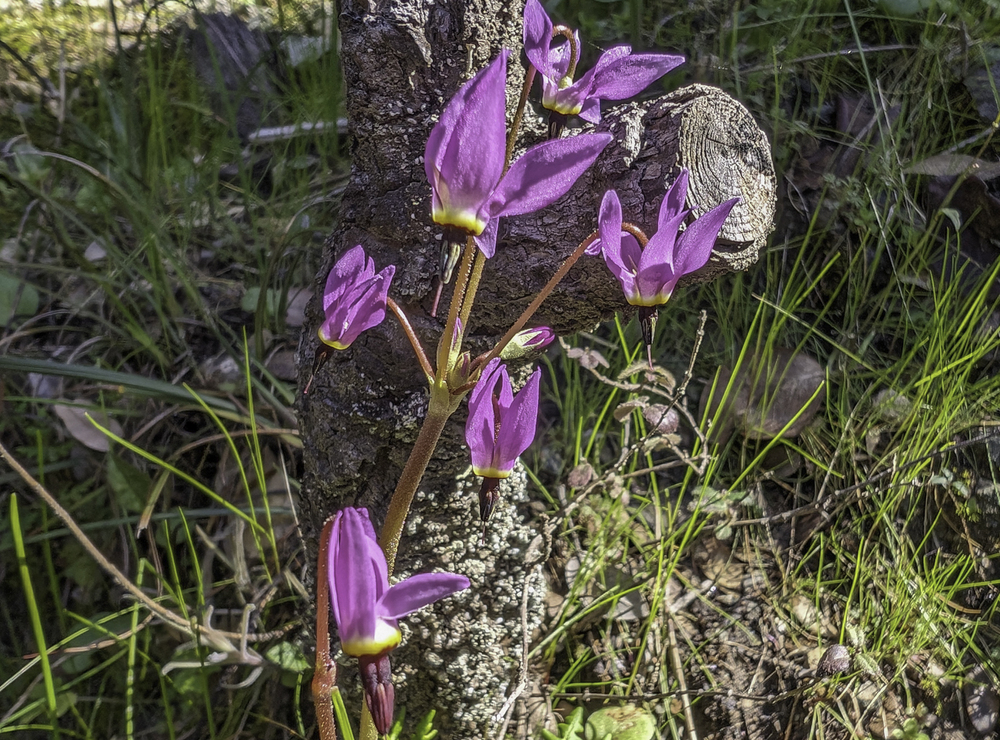
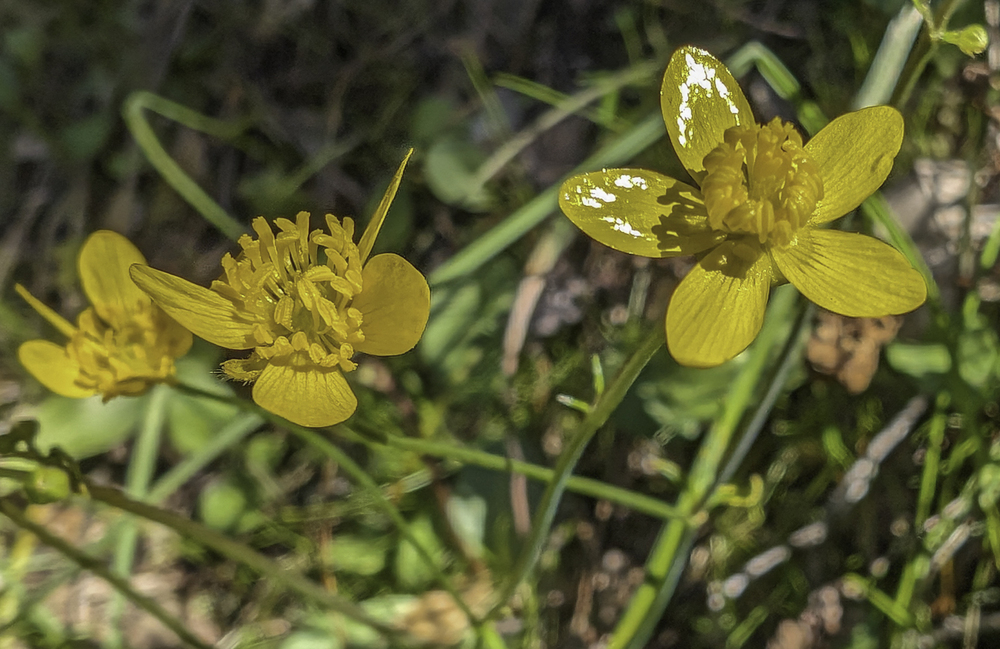
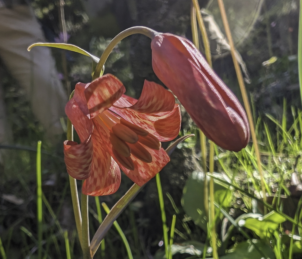
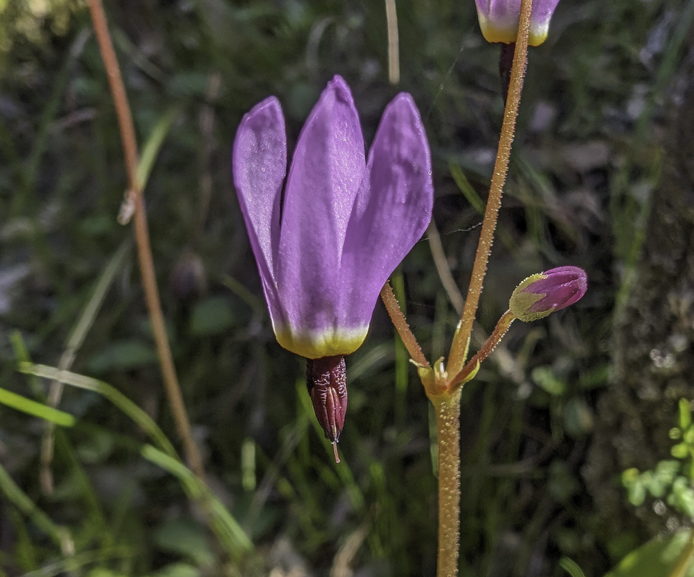
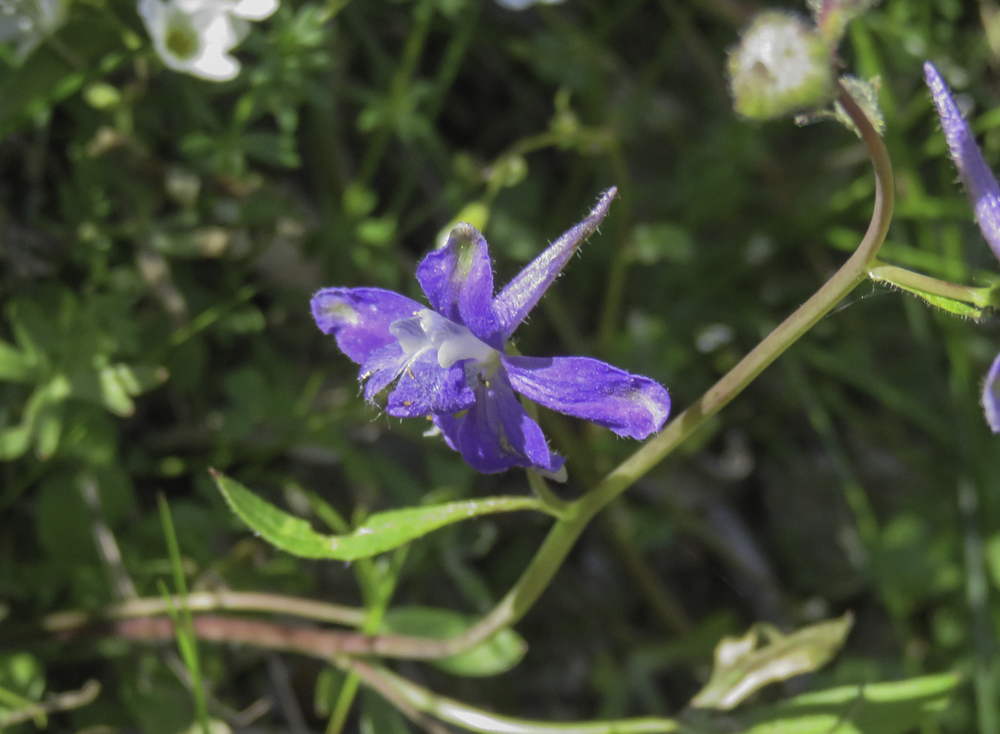
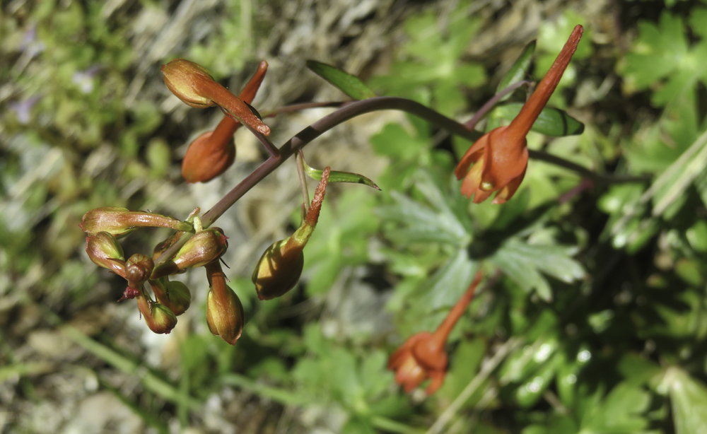
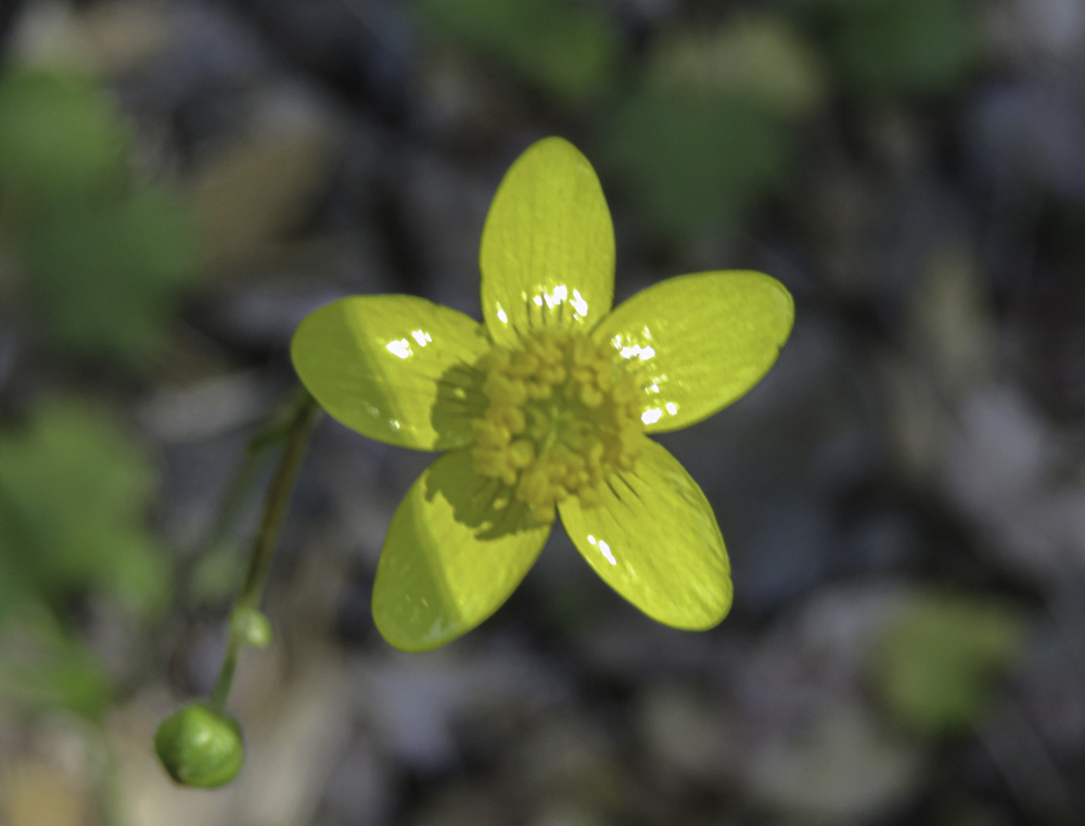
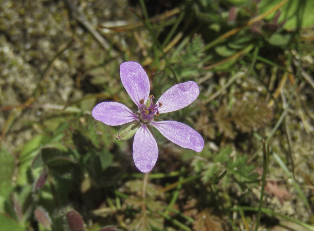
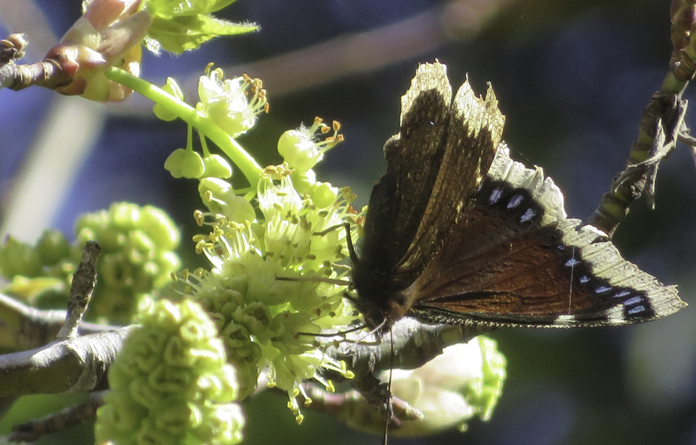
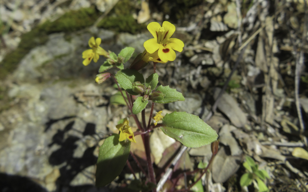
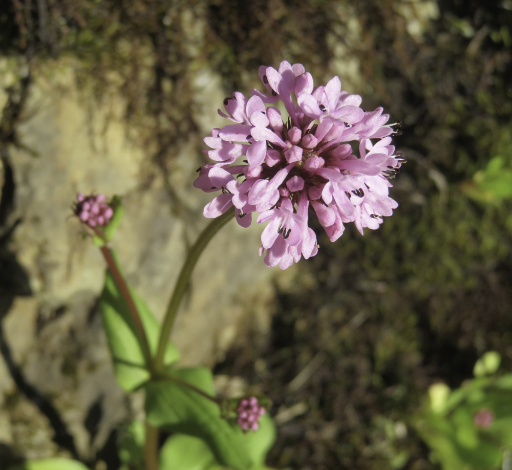
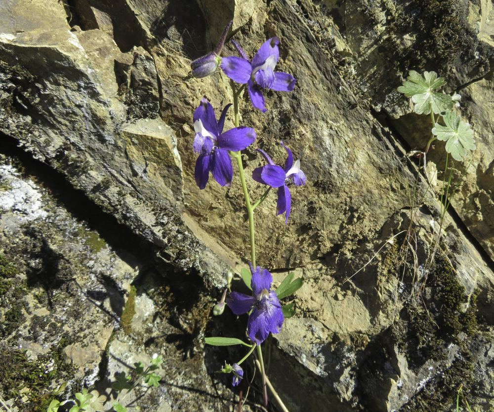
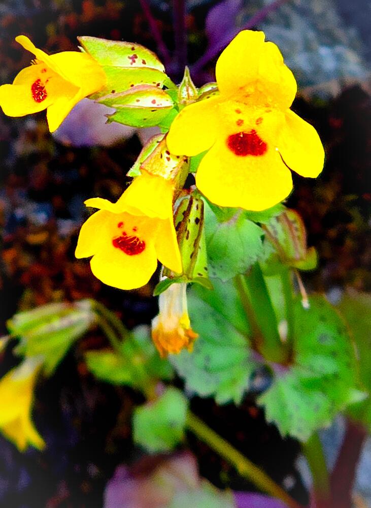
The trail quickly climbs up about fifty feet from parking where you get your first view down the green river and see the first of many early spring wildflowers. Growing from water seeping through the cracks on the cliff face were yellow Monkey Face flowers (Seep Mimulus); pink ball flowers (Rosy Plectritis), blue flowers with telltale spurs (Larkspur), normally white but showing a periwinkle shade (Milk Maids or Tooth Wort), yellow shiny leaf (Western Buttercup), perhaps the beginnings of Scarlet Gilia, Red Bells or Scarlet Fritillary, and Henderson’s Shooting Star pointing towards earth.

The array of colors from spring flowers are a special treat at this time of year along with views of the wild and scenic Rogue River.

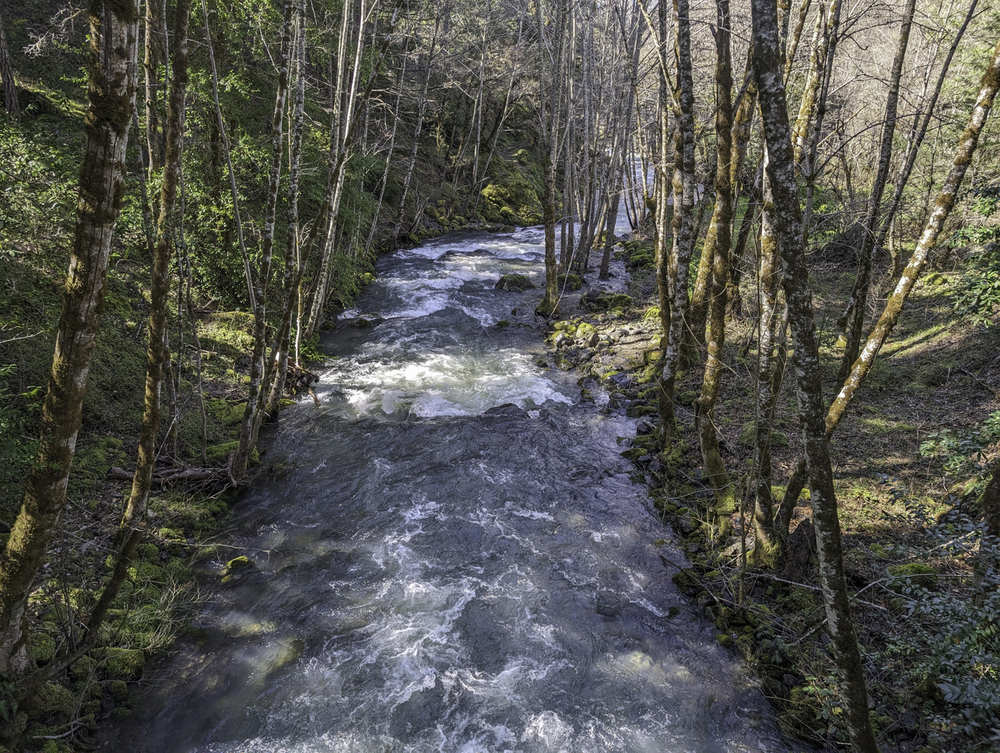
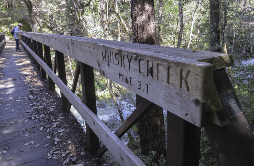
Another treat for our first timers on the trail was heading up Whisky Creek, which was roaring with white water rapids.

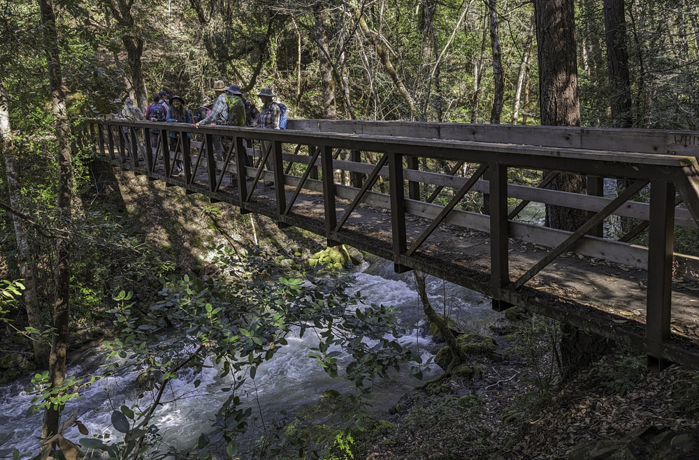
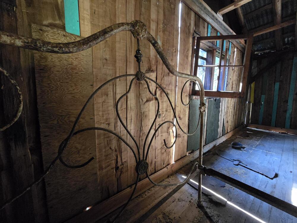
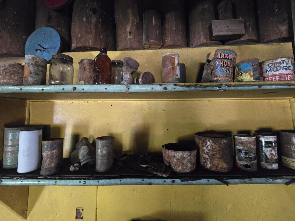
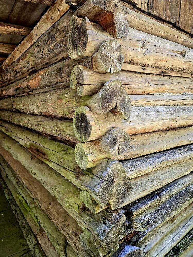
Crossing the bridge we took the short hike up to Whisky Cabin. Lew Martin, the resident gold miner in the 1950s and into the 70s, kept a one bedroom cabin that included a cold storage locker, outside shower, toilet and tool shed, and featured a ditch dug for panning gold.

After visiting the historic cabin we headed back down to have lunch by the Rogue.

Our hike from the TH to the cabin was about 4 mile on the rocky up and down trail with temps in the 60s. On the way back it was a bit more uphill as we were going up river and temps rose into the 70s, a first for 2024!

Randy’s Garmin calculated 7.3 miles RT with 800′ of elevation gain.

It was a stunningly beautiful spring day but winter plans to return next week.

Some of us stopped at the Weekend Beer Co. in Grants Pass post hike for refreshments.

Hike Leader: Rich Stickle

Photos By: Linda, Randy, Steve

Posted in Lower Rogue, Monday, Rivers & Streams

Post navigation

← Older posts
Newer posts →
↑