↓
 
Ashland Hiking Group 
 
  • About Us
  • Posted Hikes
    • Recent
    • Monday
    • Wednesday
    • Friday
    • Friday Flower
  • Hike Schedules
    • Monday
      • Current
      • Previous
    • Wednesday
      • Current
      • Previous
    • Friday
      • Current
      • Previous
    • Friday Flower
      • Current
      • Previous
  • Locations
    • Lakes
      • Applegate Lake
      • Azalea Lake
      • Castle Lake
      • Crater Lake
      • Duck Lakes
      • East Boulder Lake
      • Emigrant Lake
      • Fish Lake
      • Kangaroo Lake
      • Lost Creek Lake
      • Mountain Lakes
      • Puck Lakes
      • Seven Lakes
      • Sky Lakes
      • Smith Lake
      • Squaw Lakes
      • Taylor Lake
    • PCT
      • Brown Mountain
      • Castle Crags
      • Cement Bluff
      • Etna Summit
      • Greensprings Area
      • Gumboot Boulder
      • Hyatt/Greensprings Summit
      • Hyatt Reservoir
      • Mt Ashland Area
      • Pilot Rock Area
      • Porcupine Lake
      • Red Buttes
    • Rivers & Streams
      • Elk Creek
      • Frog Pond
      • Kelsey Creek
      • Lower Rogue
      • Mill Creek Falls
      • Sacramento River
      • Squaw Valley Creek
      • Upper Rogue
      • Taylor Creek
    • Snow Shoes
      • Buck Prairie
      • Crater Lake
      • Deadwood
      • Great Meadow
      • Grouse Gap
      • Hyatt Lake
      • Moon Prairie
      • Mt Ashland
      • Mt Shasta
      • Pederson
      • Pilot Rock
      • Summit Sno-Park
    • Mountains & Summits
      • A>L
        • Abbot Butte
        • Anderson Butte
        • Arch Rock
        • Baldy Peak
        • Big Red Mountain
        • Bolt Mountain
        • Castle Crags
        • Collings Mountain
        • Frank Hill Road
        • Grayback Mountain
        • Grizzly Peak
        • Kerby Peak
      • M>Z
        • Mount Ashland
        • Mount Bailey
        • Mount Eddy
        • Mount Elijah
        • Mount Shasta
        • Pompadour Bluff
        • Roxy Ann
        • Squaw Peak
        • Stein Butte
        • Stukel Mountain
        • Table Rocks
        • Union Peak
        • Wagner Butte
    • Woods
      • Ashland City
      • Ashland Watershed
      • Bear Creek Greenway
      • Cathedral Hills
      • Denman Wildlife Refuge
      • East Applegate Ridge
      • Enchanted Forest
      • Greenhorn Park
      • Greensprings Area
      • High Lakes Trail
      • Horseshoe Ranch
      • Jack Ash
      • Jacksonville
      • Layton Mine Ditch
      • Pacifica
      • Sterling Mine Ditch
      • Steves 40 Acres
    • Miscellaneous
  • Images
    • Resize @ 1000H ,1000V & med before uploading
  • Log In

Post navigation

← Older posts
Newer posts →

Toothpick Trail to Lewis Point

Ashland Hiking Group Posted on March 29, 2024 by Randy BryanApril 23, 2024

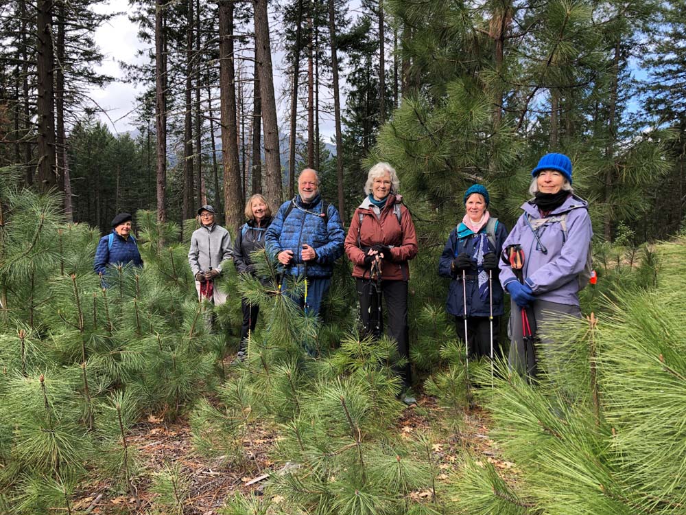
Eight Friday Mods enjoyed one of our classic hikes, Toothpick and above. We’d pivoted from our plan for Crater Lake due to road closure.

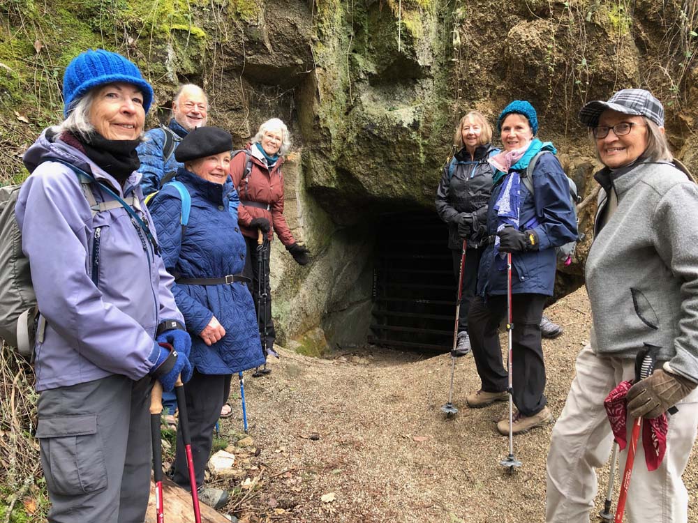
A cold and cloudy day, but with a brief sun showing and a brief sprinkle of graupel. It’s spring in Ashland. We hiked to Lamb Saddle for a break and decided to make a diversion to check out Lamb’s Mine. Mabrie and Richard started to venture in, stopped by the gate protecting the Easter bunny ‘goblins’ within, busy producing Easter eggs. We continued to the end of that short 0.8-mile trail, returning to Lamb Saddle. From there, we hiked the usual route up Caterpillar to the Gyre, Gimble, and Lewis Point intersection.

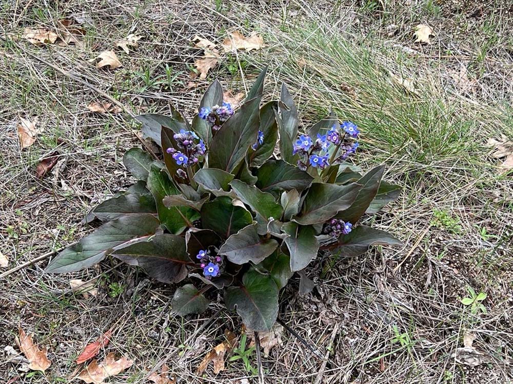
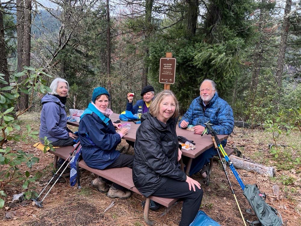
Two of us perched on logs nearby for lunch, while the other six proceeded to the picnic bench at Lewis Point. Too overcast to get the views, but they found the lovely Pacific Hound’s Tongue our in its glory. We met up at the intersection and returned together, noting a couple of the early wildflowers – tiny purple and tiny white (we’re ready to learn and relearn the names with Liz).

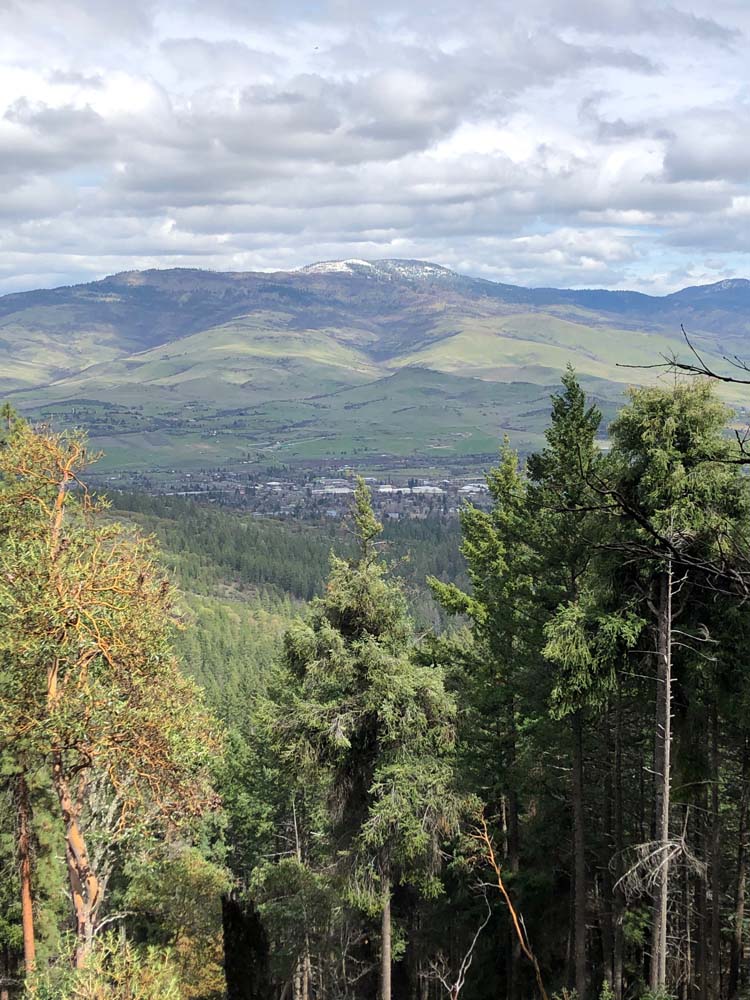
Our vista views were limited due to overcast, but enjoyed a moment of clearing for an appreciated view of Grizzly Peak and our beloved Ashland below. Two of us had hiked 5.3 miles RT with 650’ elevation gain; the Lewis Point six had hiked 6.3 miles RT and surely another 100’ for a total 750’ elevation gain.

Photos By: Elisabeth

Posted in Ashland Watershed, Friday, Woods

Post navigation

← Older posts
Newer posts →
↑