↓
 
Ashland Hiking Group 
 
  • About Us
  • Posted Hikes
    • Recent
    • Monday
    • Wednesday
    • Friday
    • Friday Flower
  • Hike Schedules
    • Monday
      • Current
      • Previous
    • Wednesday
      • Current
      • Previous
    • Friday
      • Current
      • Previous
    • Friday Flower
      • Current
      • Previous
  • Locations
    • Lakes
      • Applegate Lake
      • Azalea Lake
      • Castle Lake
      • Crater Lake
      • Duck Lakes
      • East Boulder Lake
      • Emigrant Lake
      • Fish Lake
      • Kangaroo Lake
      • Lost Creek Lake
      • Mountain Lakes
      • Puck Lakes
      • Seven Lakes
      • Sky Lakes
      • Smith Lake
      • Squaw Lakes
      • Taylor Lake
    • PCT
      • Brown Mountain
      • Castle Crags
      • Cement Bluff
      • Etna Summit
      • Greensprings Area
      • Gumboot Boulder
      • Hyatt/Greensprings Summit
      • Hyatt Reservoir
      • Mt Ashland Area
      • Pilot Rock Area
      • Porcupine Lake
      • Red Buttes
    • Rivers & Streams
      • Elk Creek
      • Frog Pond
      • Kelsey Creek
      • Lower Rogue
      • Mill Creek Falls
      • Sacramento River
      • Squaw Valley Creek
      • Upper Rogue
      • Taylor Creek
    • Snow Shoes
      • Buck Prairie
      • Crater Lake
      • Deadwood
      • Great Meadow
      • Grouse Gap
      • Hyatt Lake
      • Moon Prairie
      • Mt Ashland
      • Mt Shasta
      • Pederson
      • Pilot Rock
      • Summit Sno-Park
    • Mountains & Summits
      • A>L
        • Abbot Butte
        • Anderson Butte
        • Arch Rock
        • Baldy Peak
        • Big Red Mountain
        • Bolt Mountain
        • Castle Crags
        • Collings Mountain
        • Frank Hill Road
        • Grayback Mountain
        • Grizzly Peak
        • Kerby Peak
      • M>Z
        • Mount Ashland
        • Mount Bailey
        • Mount Eddy
        • Mount Elijah
        • Mount Shasta
        • Pompadour Bluff
        • Roxy Ann
        • Squaw Peak
        • Stein Butte
        • Stukel Mountain
        • Table Rocks
        • Union Peak
        • Wagner Butte
    • Woods
      • Ashland City
      • Ashland Watershed
      • Bear Creek Greenway
      • Cathedral Hills
      • Denman Wildlife Refuge
      • East Applegate Ridge
      • Enchanted Forest
      • Greenhorn Park
      • Greensprings Area
      • High Lakes Trail
      • Horseshoe Ranch
      • Jack Ash
      • Jacksonville
      • Layton Mine Ditch
      • Pacifica
      • Sterling Mine Ditch
      • Steves 40 Acres
    • Miscellaneous
  • Images
    • Resize @ 1000H ,1000V & med before uploading
  • Log In

Post navigation

← Older posts
Newer posts →

Jacksonville Woodlands

Ashland Hiking Group Posted on January 17, 2024 by Randy BryanApril 23, 2024

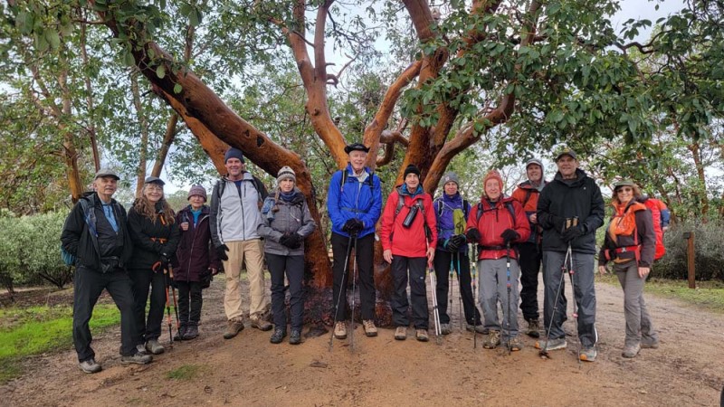
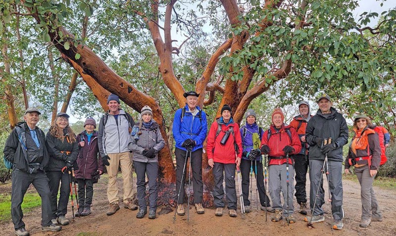
We had 12 hikers come out in weather that was predicted to rain. Fortunately we never had much more than some sprinkles along the way. New hiker Michael B from Jacksonville joined us.

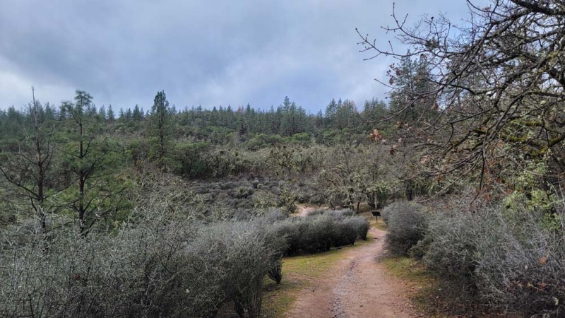
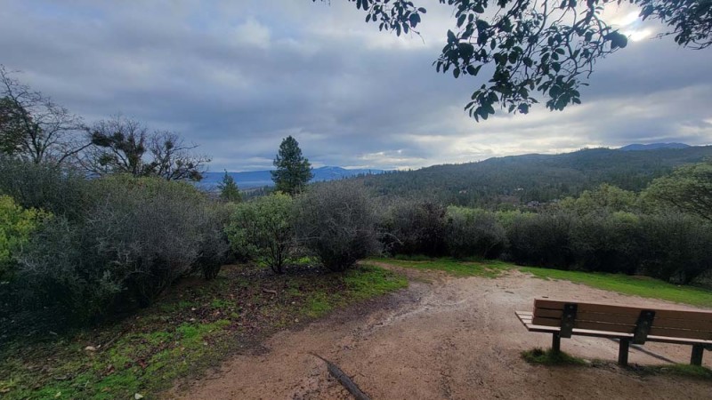
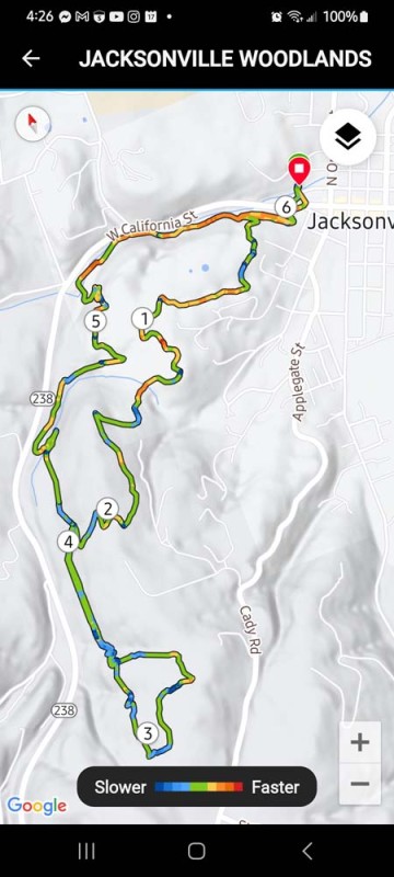
We started at the far parking lot of the Jacksonville library and headed across Highway 238, up the stairs near the Britt Gardens and into the Jacksonville Woodlands via the Sarah Ziglar trail. We then connected to the Britt Canyon trail to Rich Gulch Trail and on up to Panorama Point.

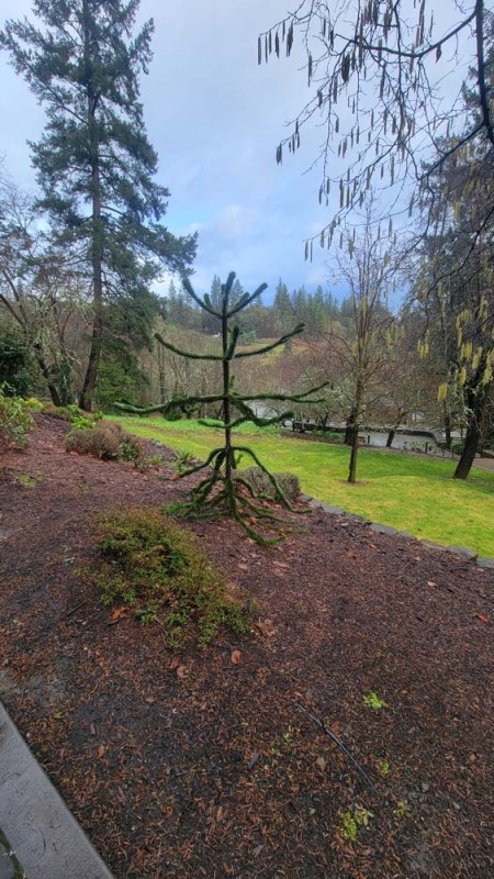
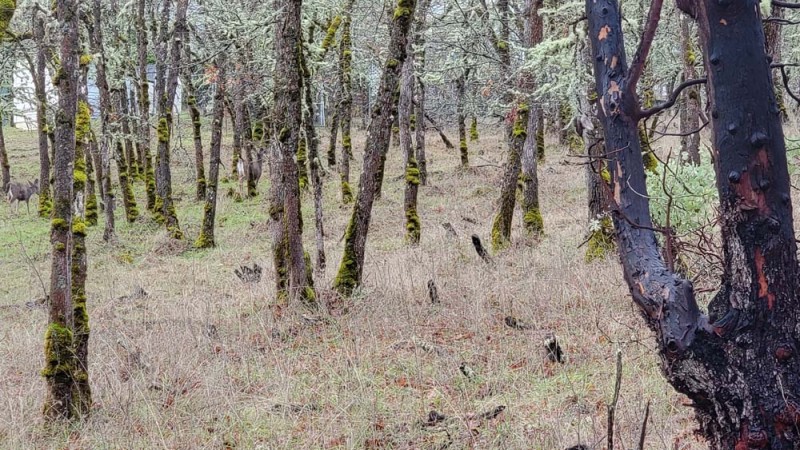
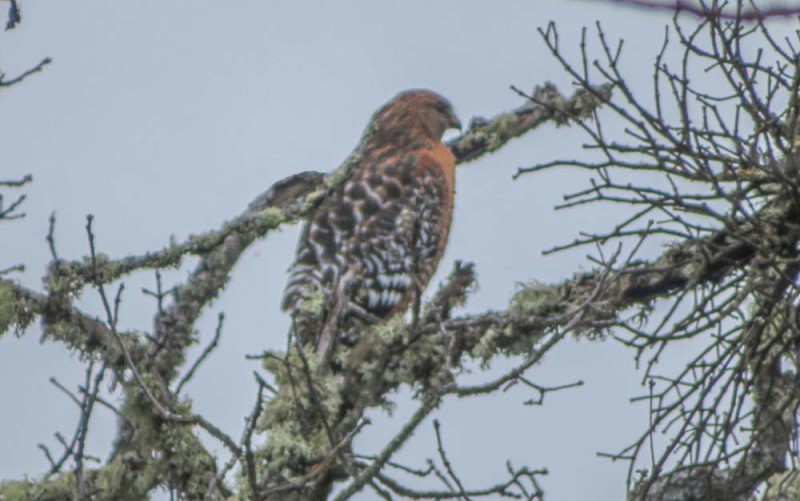
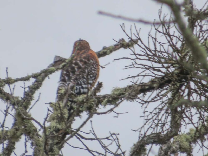
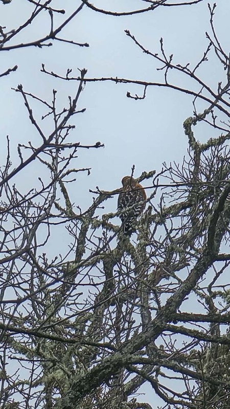
The clouds were low and we were unable to see Mount McLoughlin. We took our group shot at the big manzanita tree. We continued on Rich Gulch to Petard Ditch to White Oak and up to Liz’s Loop. Somewhere along the way, Linda spotted a Red Shouldered Hawk.

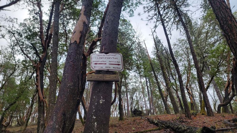
As we got to the Burn and Hurl Loop Hank decided to take the Guaranteed Burn to the left while the rest of us took the Optional Hurl. We met part way around the loop with Hank traveling farther than we did. Scott went back with Hank and we took a snack break. We continued around the loop and came back down the Petard Ditch Loop trail and we were greeted with excited barks from 2 dogs as we passed their property fence line.

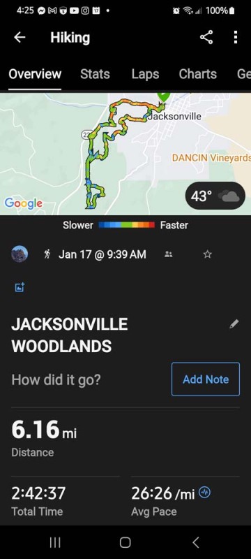
We then went down to the South Fork View trail that goes along the South Fork of Jackson Creek. We then connected to the Jane Naverson trail down to a parking lot and then connected back on the Sarah Ziglar trail and back to our cars by 1:00 PM.

Hike Date: 2024-01-17

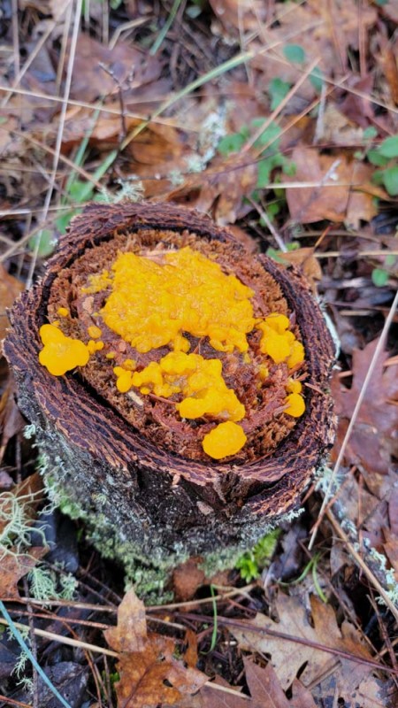
Photos By: Linda and Francie

Download GPX

Posted in Jacksonville, Wednesday, Woods

Post navigation

← Older posts
Newer posts →
↑