↓
 
Ashland Hiking Group 
 
  • About Us
  • Posted Hikes
    • Recent
    • Monday
    • Wednesday
    • Friday
    • Friday Flower
  • Hike Schedules
    • Monday
      • Current
      • Previous
    • Wednesday
      • Current
      • Previous
    • Friday
      • Current
      • Previous
    • Friday Flower
      • Current
      • Previous
  • Locations
    • Lakes
      • Applegate Lake
      • Azalea Lake
      • Castle Lake
      • Crater Lake
      • Duck Lakes
      • East Boulder Lake
      • Emigrant Lake
      • Fish Lake
      • Kangaroo Lake
      • Lost Creek Lake
      • Mountain Lakes
      • Puck Lakes
      • Seven Lakes
      • Sky Lakes
      • Smith Lake
      • Squaw Lakes
      • Taylor Lake
    • PCT
      • Brown Mountain
      • Castle Crags
      • Cement Bluff
      • Etna Summit
      • Greensprings Area
      • Gumboot Boulder
      • Hyatt/Greensprings Summit
      • Hyatt Reservoir
      • Mt Ashland Area
      • Pilot Rock Area
      • Porcupine Lake
      • Red Buttes
    • Rivers & Streams
      • Elk Creek
      • Frog Pond
      • Kelsey Creek
      • Lower Rogue
      • Mill Creek Falls
      • Sacramento River
      • Squaw Valley Creek
      • Upper Rogue
      • Taylor Creek
    • Snow Shoes
      • Buck Prairie
      • Crater Lake
      • Deadwood
      • Great Meadow
      • Grouse Gap
      • Hyatt Lake
      • Moon Prairie
      • Mt Ashland
      • Mt Shasta
      • Pederson
      • Pilot Rock
      • Summit Sno-Park
    • Mountains & Summits
      • A>L
        • Abbot Butte
        • Anderson Butte
        • Arch Rock
        • Baldy Peak
        • Big Red Mountain
        • Bolt Mountain
        • Castle Crags
        • Collings Mountain
        • Frank Hill Road
        • Grayback Mountain
        • Grizzly Peak
        • Kerby Peak
      • M>Z
        • Mount Ashland
        • Mount Bailey
        • Mount Eddy
        • Mount Elijah
        • Mount Shasta
        • Pompadour Bluff
        • Roxy Ann
        • Squaw Peak
        • Stein Butte
        • Stukel Mountain
        • Table Rocks
        • Union Peak
        • Wagner Butte
    • Woods
      • Ashland City
      • Ashland Watershed
      • Bear Creek Greenway
      • Cathedral Hills
      • Denman Wildlife Refuge
      • East Applegate Ridge
      • Enchanted Forest
      • Greenhorn Park
      • Greensprings Area
      • High Lakes Trail
      • Horseshoe Ranch
      • Jack Ash
      • Jacksonville
      • Layton Mine Ditch
      • Pacifica
      • Sterling Mine Ditch
      • Steves 40 Acres
    • Miscellaneous
  • Images
    • Resize @ 1000H ,1000V & med before uploading
  • Log In

Post navigation

← Older posts
Newer posts →

Castle Crags and Hedge Creek Falls

Ashland Hiking Group Posted on May 13, 2024 by Randy BryanMay 19, 2024

The Monday hike group left Ashland at 8 am for our drive down into California. It was a clear blue sky day with no smoke from seasonal wildfires.
The plan was for two hikes, a short bonus hike to Hedge Creek Falls off Exit 724, then the main event up the Castle Crags off Exit 732 (Castella).
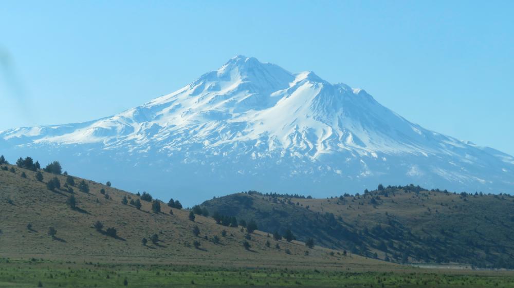
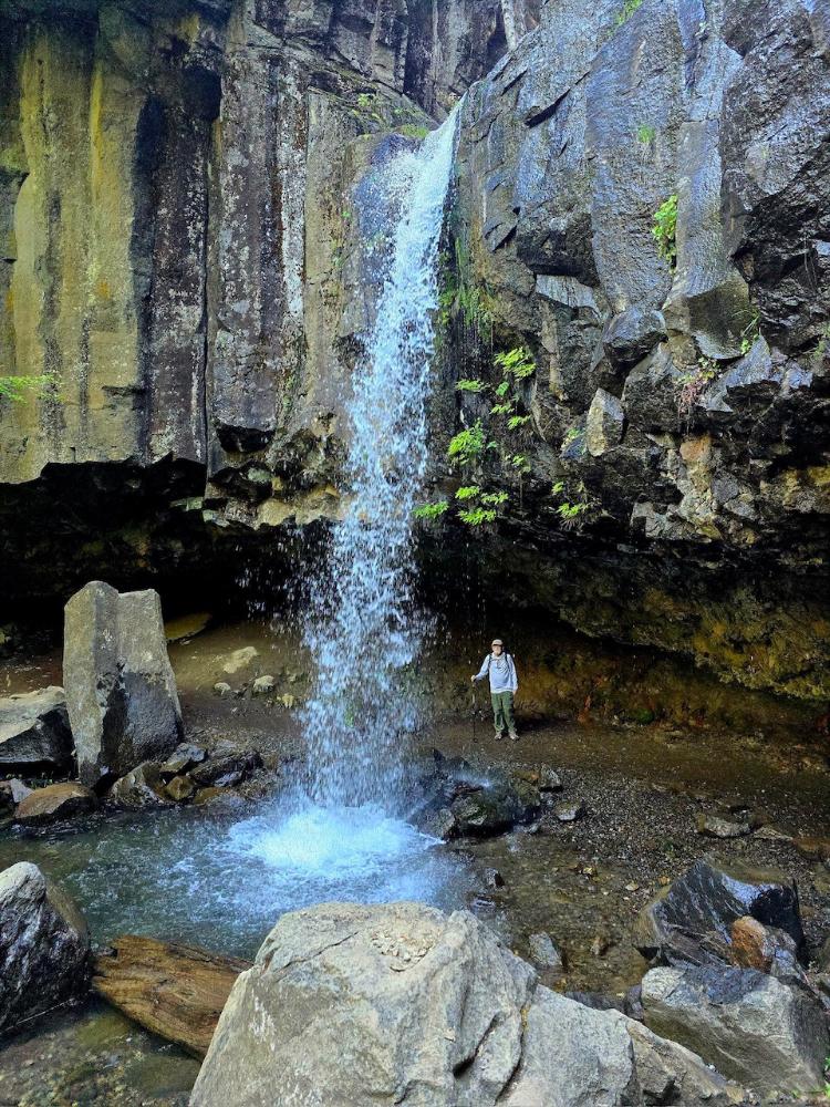
We made good time on I-5 even with lanes closed for road work. We arrived across from the Falls trail shortly after 9 am. The trail descends into a canyon towards the showering falls. Hedge Creek Falls is special because there’s room to walk behind the falls and continue on the trail to an observation deck. The deck offers a view of the confluence of the Sacramento River and Hedge Creek joining. And, upriver, Mt Shasta is seen rising over the canyon.
These rewarding sights are completed in just 1.2 miles RT with a gain of 140′.
Then, it’s just a short drive down the freeway to Exit 732 and the entrance into Castle Crags State Park. The Park fee is $7 per car for seniors and the young Ranger advised us to carry plenty of water for the warm uphill hike.
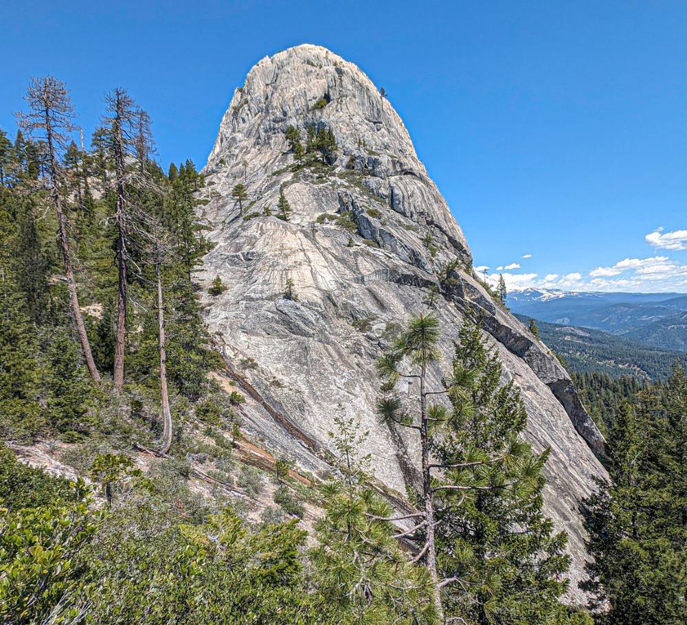
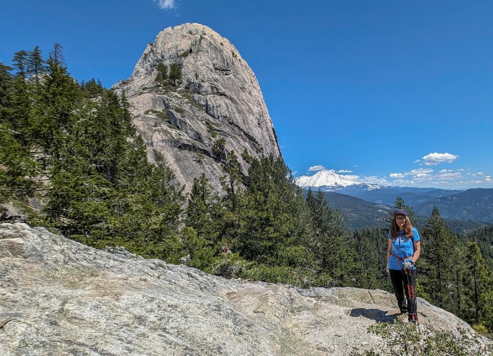
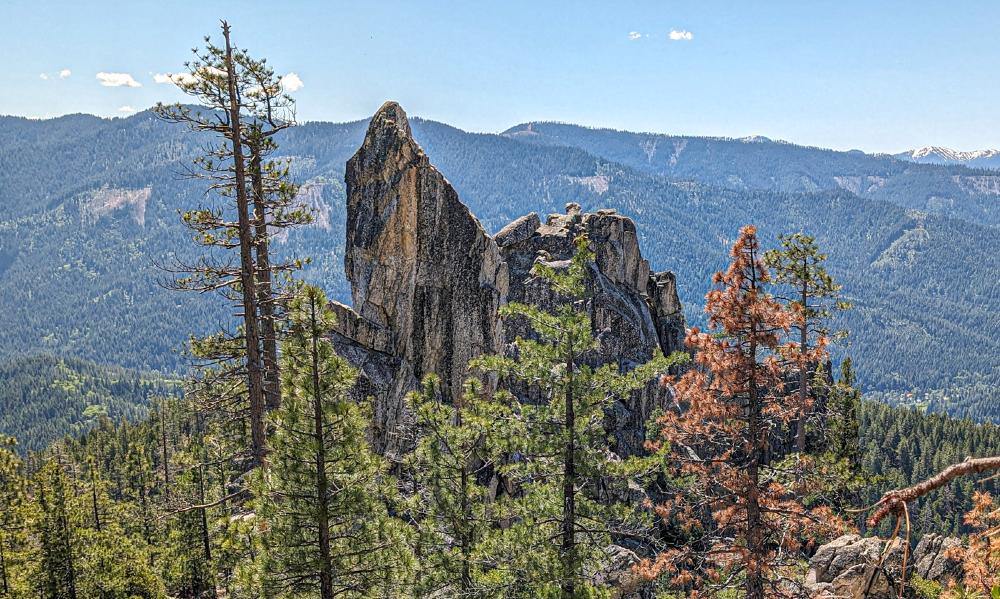
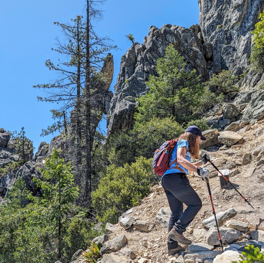
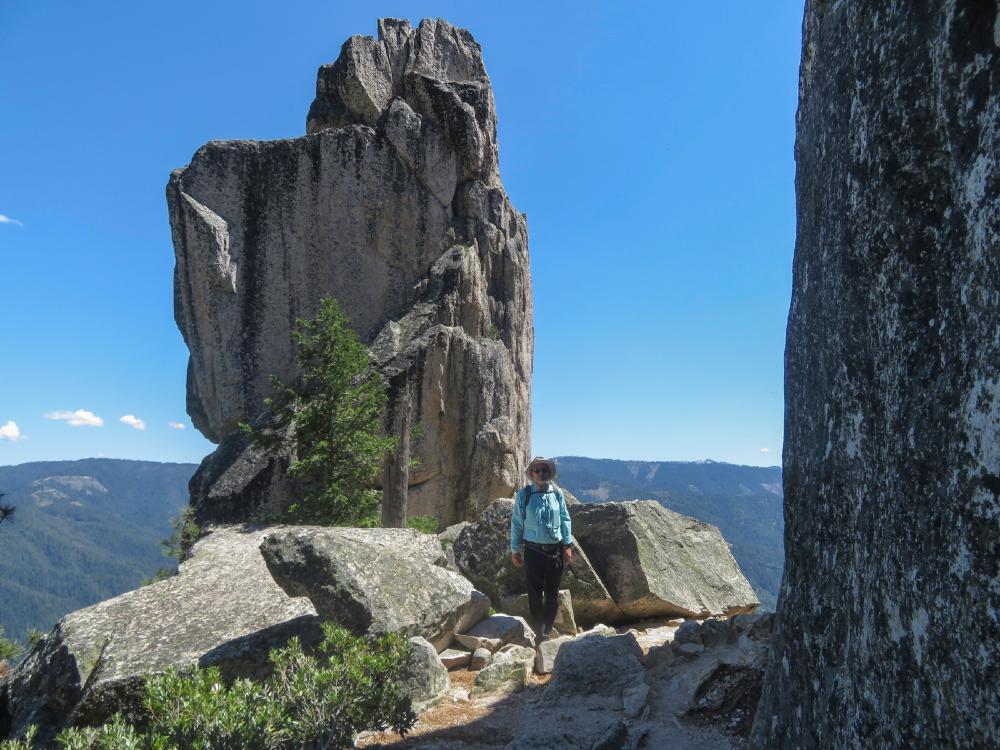
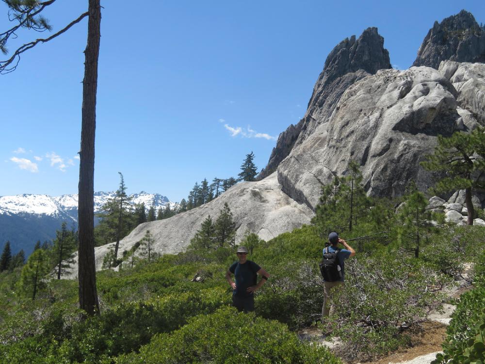
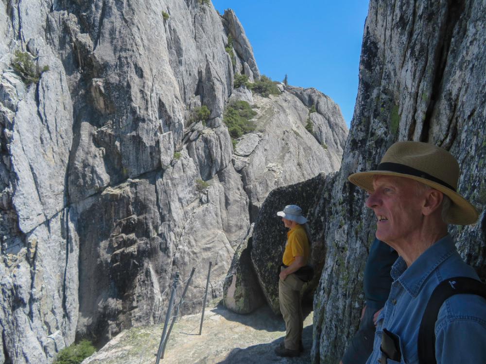
From the entrance, it’s a windy 2.1 drive up to Vista Point parking, with a short downhill walk to the Crags Trail. After about a quarter mile of level trail, the Crags Trail splits off from the Root Creek Trail and heads uphill for 2.8 miles to the top of the Crags. The first half of the climb is through the forest with intermittent shade. Then the last half is an exposed rocky trail up to the lunch spot at the base of Castle Dome. Monday’s temperatures ranged from low 70s to mid 80s.
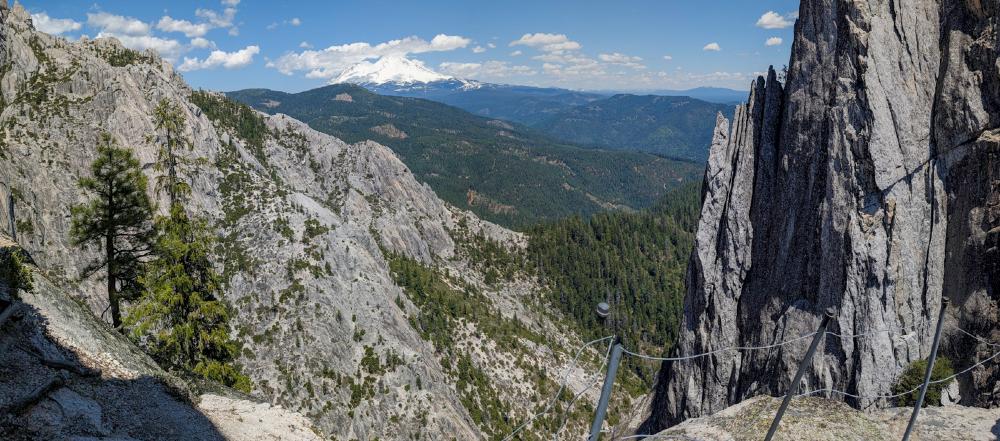
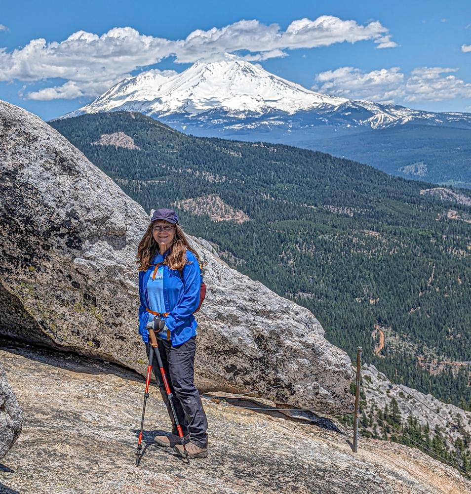
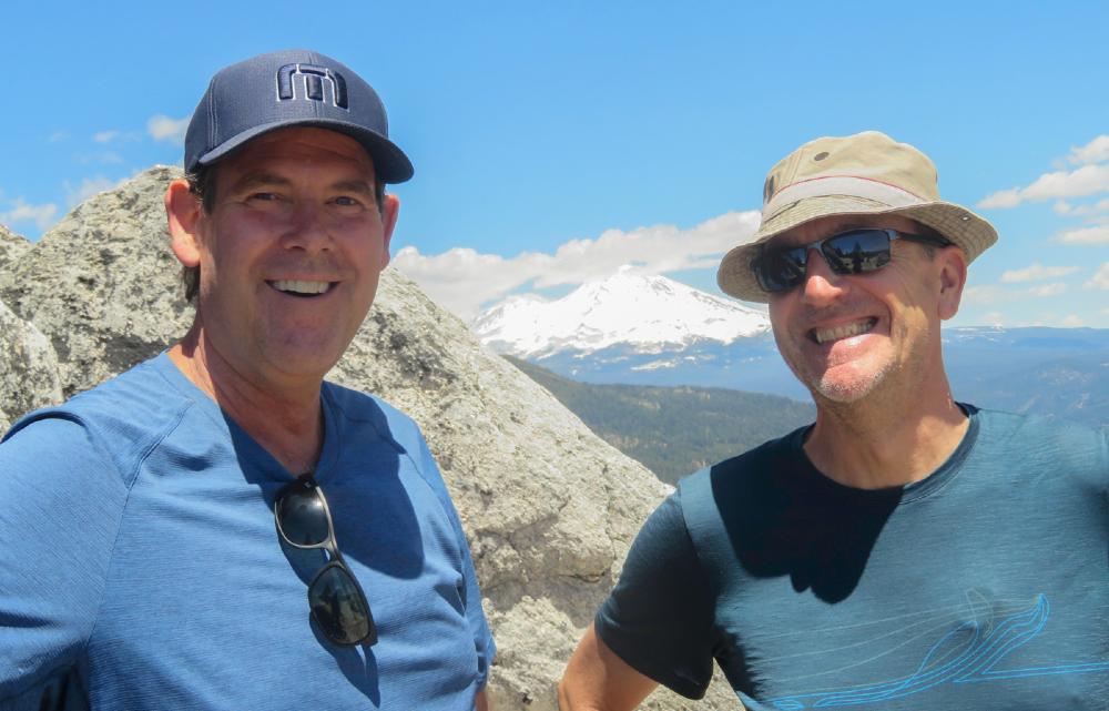
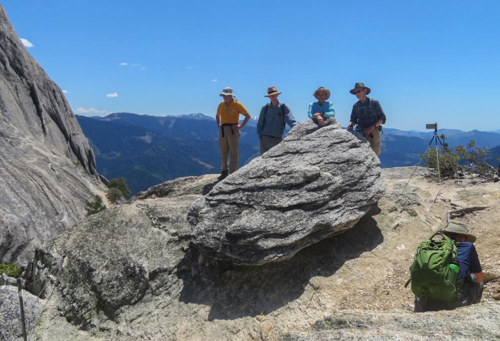
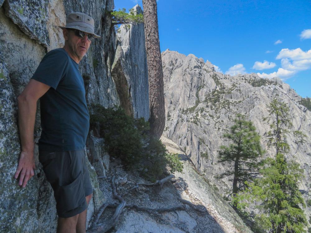
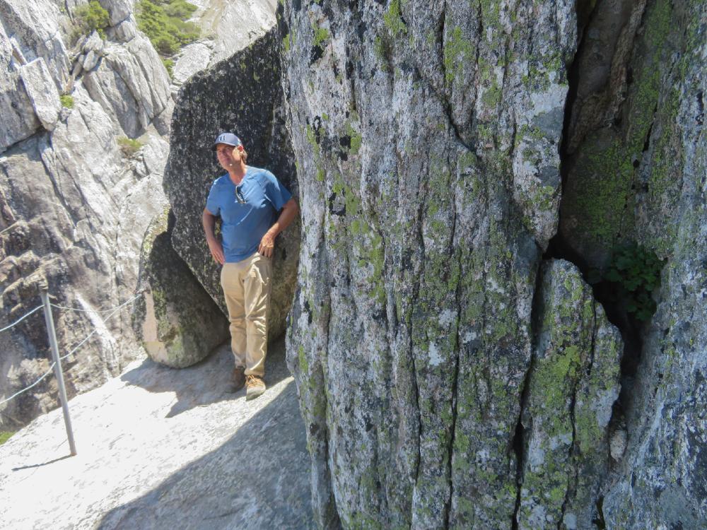
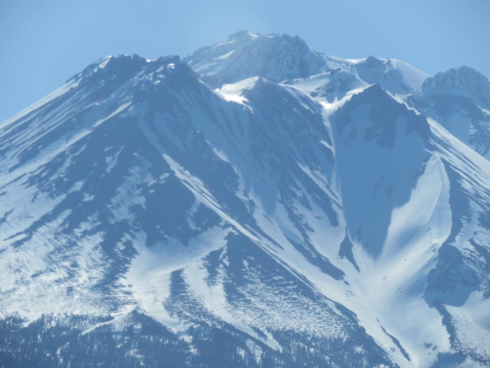
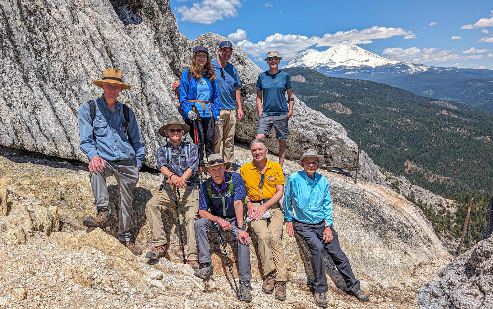
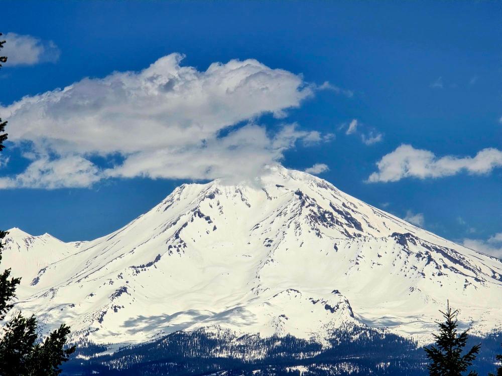
After lunch, there’s a short hike up the Dome and a crawl out to an east-facing cliff with a guarding cable for a spectacular view of snow-covered Mt Shasta.
The hike down is not as physically demanding as the hike up but you still must be aware of loose gravel on the rocks.
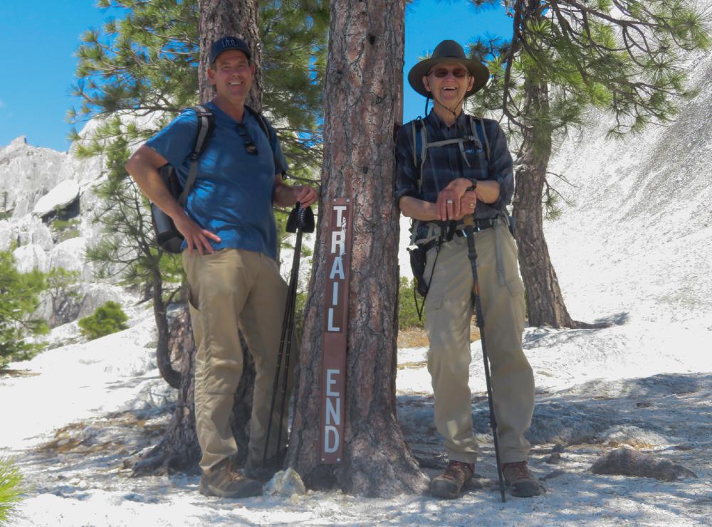
We had 4 newbies and 6 veterans hiking the Crags Monday for this most demanding and rewarding experience.
Back at the parking, we had cold bottled water for our thirsty hikers.
We stopped at Yak’s in Dunsmuir for post-hike refreshments and arrived back in Ashland by 5 pm.

Hike Leader: Rich Stickle

Photos By: Steve, Rich, Linda, Randy

Posted in Castle Crags, Monday, Mountains & Summits

Post navigation

← Older posts
Newer posts →
↑