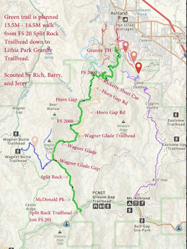
Lithia Park to Horn Gap Road
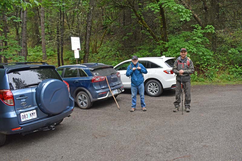
We had an early start Monday morning as we were heading up into the Ashland Watershed for parts unknown. Jerry, Barry and myself met at the top of Lithia Park at 8 am to go scout out the elusive Horn Gap Road. I had made a couple of previous solo attempts to find it and had asked both hikers and bikers I met along the way, but with no luck.
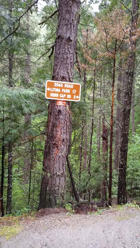
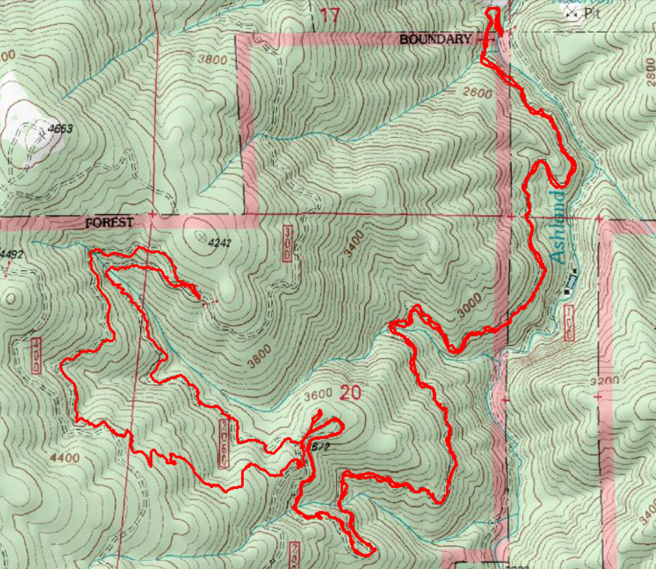
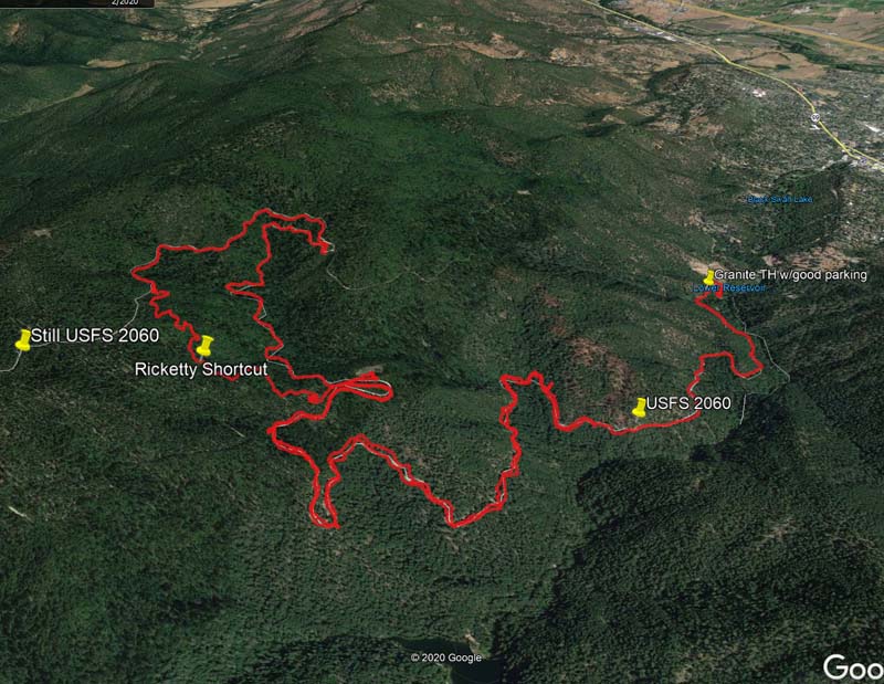
So thinking that three heads are better than one, especially when the other two heads have Gaia tracking apps, we headed up Horn Creek Road (aka FS 2060) under threatening skies.
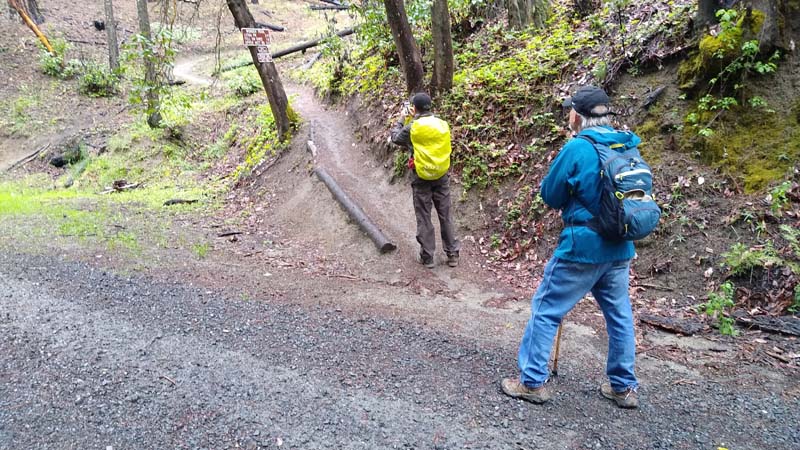
A quarter mile up, we came to a locked gate that prevents vehicles from going further but not hikers or mountain bikers. The dirt and gravel road is in good shape with no potholes. It’s a steady assent but not particularly steep. Along the way we stopped often to look down into the forest for the Reeder Reservoir. Though the forest is thick we did get a few glimpses of Ashland’s water source.
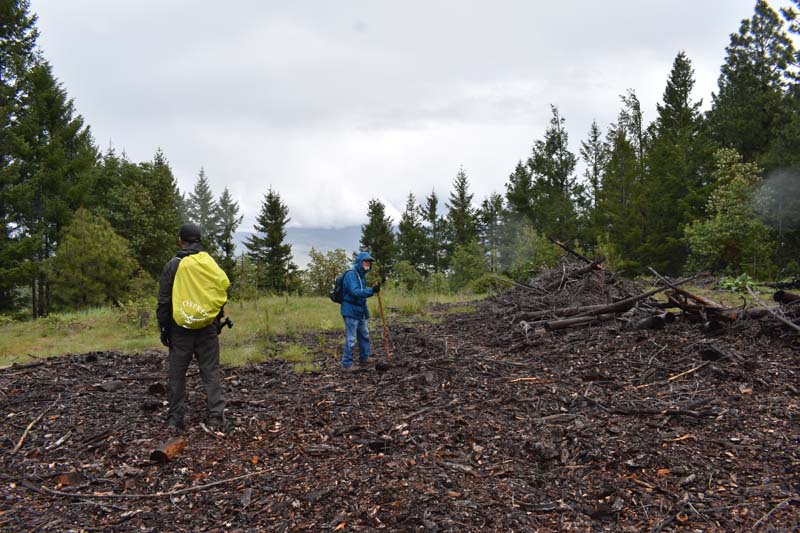
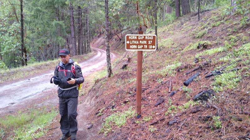
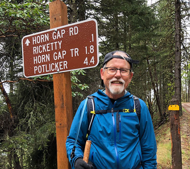
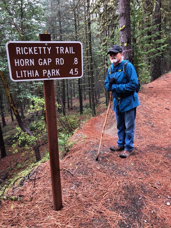
Through intermittent showers, we kept heading up in search of Horn Gap Road. Finally, at 3.7 miles from Lithia Park we saw FS 2060 turn off to the right and ahead of us was Horn Gap Road! Not flattened out as described in a Mail Tribune article but still heading up. So after a brief discussion we decided to get off the road and take the Rikkety Trail foot path 0.8 of a mile up and over a steep hill and back to 2060.
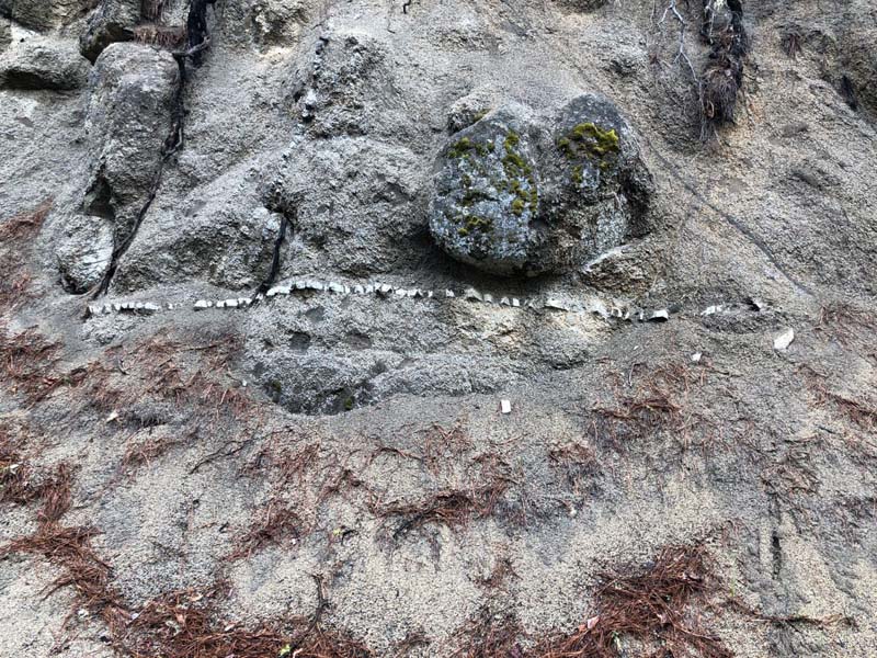
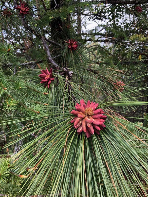
There were several wildflowers up on Rikkety Hill that were captured on camera. There were also ample signs of a fairly intense wild fire on the trail and on FS 2060.
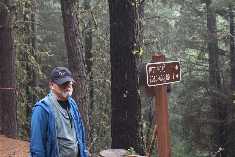
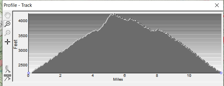
We stopped for lunch when we got off the trail and sat by a sign that said 4.5 miles back to Lithia Park. We were at 4,200 feet. The hike back was almost all downhill and featured the heaviest rain of the day.
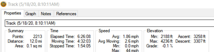
We got back to our cars at 2:30 after 6 1/2 hours on the trail covering almost 12 miles. The Three Amigos were glad for our time together and ready for a visit to Louie’s.
Hike Leader: Rich Stickle
Photos By: Barry, Gary